Nar Phu Valley Trek: 14 Days Complete Itinerary and Guide

Annapurna, Gandaki Province, Nepal

1 Day

Trek Region

Annapurna / Nar Phu Valley

Group Size

1-12 trekkers (Private & Small Group)

The Nar Phu Valley Trek is a remote Himalayan trek in Nepal’s Annapurna region, leading you into the hidden villages of Nar and Phu near the Tibetan border. The trail is quieter than the main Annapurna routes and passes through canyons, pine forests, river valleys, high pastures, rocky cliffs, and dry alpine landscapes.

Along the way, you experience ancient stone villages, Buddhist monasteries, prayer flags, mani walls, and Tibetan-influenced culture. This 14-day itinerary follows the route from Kathmandu to Besisahar, Koto, Meta, Kyang, Phu, Nar Phedi, Nar, and Kang La Pass before descending to Ngawal and returning to Kathmandu.

Trip Info 

  • Koto, after driving from Kathmandu through Besisahar
  • Ngawal, then drive back to Besisahar and Kathmandu
  • Approx. 80 to 95 km / 50 to 59 miles, depending on side hikes and road conditions
  • Trekking/Hiking + Scenic Drive
  • Moderate to Challenging
  • March to May and September to November
  • Kang La Pass, approx. 5,306m / 17,408ft
  • 4 to 9 hours
  • Nar Phu Restricted Area Permit and ACAP Permit
  • Hotel in Kathmandu; local lodges and teahouses during the trek
  • Breakfast, lunch, and dinner during the trek
  • Licensed guide and porter available;1 porter for 2 trekkers

Why Trek to Nar Phu Valley

The Nar Phu Valley Trek is one of the best remote treks in Nepal. It is perfect for travelers who want a quieter route than the regular Annapurna trails. The trek takes you into the restricted Nar Phu area, a hidden valley known for old villages, dry cliffs, deep gorges, Buddhist culture, yak pastures, and wide mountain views. The walking route begins from Koto and slowly moves away from road-accessible villages into peaceful mountain landscapes.

As you walk toward Meta, Kyang, Phu, Nar Phedi, and Nar, the scenery keeps changing. The trail moves from forested river paths to dry and rugged Himalayan terrain. You also get a close look at village life in Phu and Nar, where you see stone houses, chortens, monasteries, prayer flags, and local mountain traditions. Kang La Pass adds the main adventure, with a high and windy crossing before the trail descends to Ngawal and reconnects with the wider Annapurna region.

Trek Highlights 

  • Walk through the restricted Nar Phu Valley, a great option for remote trekking areas in the Annapurna region.
  • Visit the ancient villages of Phu and Nar, known for Tibetan-influenced culture, stone houses, monasteries, and prayer walls.
  • Cross Kang La Pass, the highest point of the trek, at around 5,306m / 17,408ft.
  • Enjoy mountain views of Annapurna II, Gangapurna, Tilicho Peak, Chulu peaks, and nearby Himalayan ranges.
  • Follow a scenic route through Koto, Meta, Kyang, Phu, Nar Phedi, Nar, and Ngawal.
  • Experience a quieter trail compared to the classic Annapurna Base Camp and Annapurna Circuit routes.
  • Walk through narrow canyons, suspension bridges, pine forests, rocky cliffs, high pastures, and dry alpine landscapes.

Tour Plan

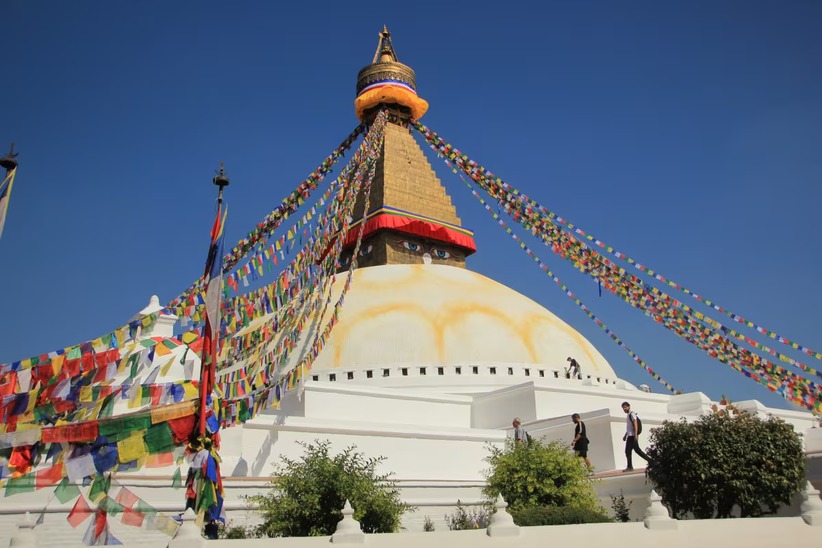
You arrive at Tribhuvan International Airport in Kathmandu, where our team welcomes you and transfers you to your hotel. After check-in, you can rest from your international flight or take a short walk around Thamel.

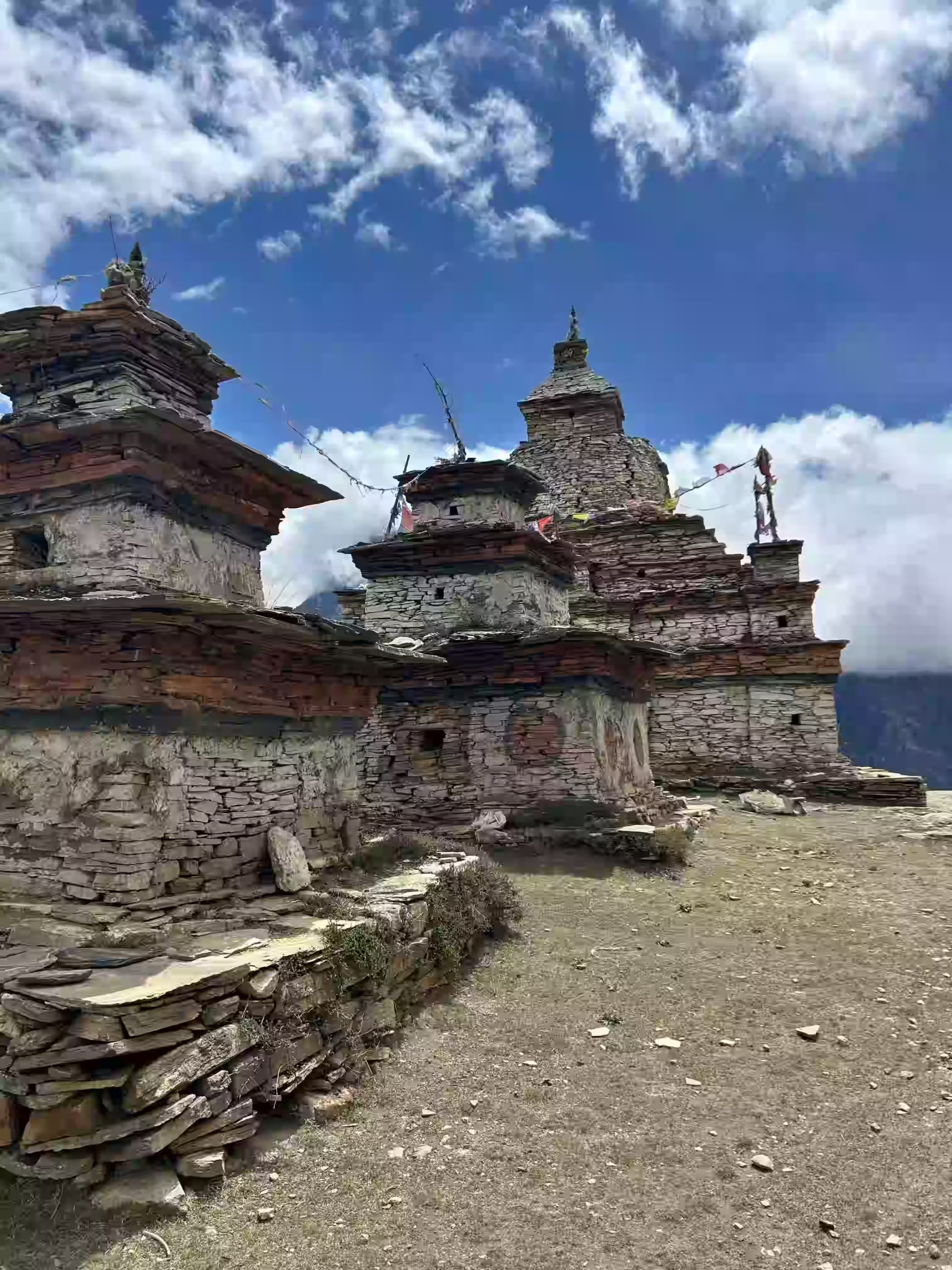
Later, you meet your guide for a short trek briefing. The guide explains the Nar Phu Valley Trek itinerary, daily walking hours, permits, transport, accommodation, packing details, and high-altitude safety.

Trip duration: 25 to 30 minutes taxi ride from the airport to your hotel

Note: Keep your passport, travel insurance, and passport-size photos ready for permit processing.

Your journey begins with an early morning departure from Kathmandu, heading toward Besisahar, the gateway town for many Annapurna region treks. The drive follows the Prithvi Highway at first, passing rivers, terraced fields, roadside towns, and hill settlements.

As you get closer to Besisahar, the scenery begins to feel more rural. Besisahar is the district headquarters of Lamjung and an important road point before heading deeper toward the Marsyangdi Valley.

Drive duration: 6 to 7 hours

Driving distance: Approx. 175 km / 109 miles

Maximum altitude: 760m / 2,493ft

Elevation gain: -635m / -2,083ft

Note: The drive can feel long because of traffic and road conditions, so keep water, snacks, and light essentials in your day bag.

Leaving Besisahar behind, you swap the highway for a rugged mountain road tracing the Marsyangdi River valley and pass through places such as Syange, Jagat, Dharapani, Timang, and Chame before reaching Koto.

Koto is the entry point for the Nar Phu Valley restricted area and has a rough mountain road. Nonetheless, it gives you your first close look at the Annapurna region's changing landscapes. You pass waterfalls, cliffs, forested hills, and mountain villages before entering the higher valley.

Drive duration: 6 to 7 hours

Driving distance: Approx. 65 to 75 km / 40 to 47 miles

Maximum altitude: 2,600m / 8,530ft

Elevation gain: +1,840m / +6,037ft

Note: The road from Besisahar to Koto is rough in several sections. Plus, keep your warm jacket nearby because the temperature drops as you gain altitude.

Your Nar Phu Valley Trek officially begins from Koto. After checking the restricted area permit, you leave the main Annapurna trail and enter the remote valley section. The trail follows the Nar Khola through forested paths, river crossings, suspension bridges, and narrow canyon sections.

The walk is long and steady, with several uphill parts. As you move higher, the forest opens into drier terrain, and the valley starts to feel more isolated. After a gradual climb, you reach Meta, a small settlement with wide views of the surrounding hills and peaks.

Trek duration: 6 to 7 hours

Trek distance: Approx. 13 to 14 km / 8 to 8.7 miles

Maximum altitude: 3,560m / 11,680ft

Elevation gain: +960m / +3,150ft

Note: This is your first trekking day and includes steady altitude gain, so walk slowly and avoid rushing.

The trail pushes deeper into the Nar Phu Valley this day, guiding you through dry alpine terrain and open ridges, old settlement areas, and yak grazing landscapes. The views become wider, and the route starts showing the raw beauty of this remote Himalayan valley.

Kyang is a quiet stop surrounded by cliffs, open slopes, and mountain scenery. It gives you a good halfway point before continuing to Phu the next day. The walking time is shorter than the previous day, which helps your body adjust to the higher altitude.

Trek duration: 4 to 5 hours

Trek distance: Approx. 10 to 12 km / 6.2 to 7.5 miles

Maximum altitude: 3,820m / 12,533ft

Elevation gain: +260m / +853ft

Note: Facilities become more basic as you move toward Phu, so keep your power bank charged and carry enough cash.

A spectacular trek awaits as you head toward Phu, passing rugged landscapes, dry cliffs, old chortens, mani walls, and open valley sections before reaching the ancient village of Phu.

Phu sits in a dramatic high-altitude setting close to the Tibetan border. The village is known for its stone houses, narrow lanes, Buddhist culture, and nearby monastery. After arrival, you can rest and take a short walk around the village if you feel comfortable.

Trek duration: 4 to 5 hours

Trek distance: Approx. 8 to 10 km / 5 to 6.2 miles

Maximum altitude: 4,080m / 13,386ft

Elevation gain: +260m / +853ft

Note: You sleep above 4,000m / 13,000ft tonight, so drink enough water and tell your guide if you feel a headache, nausea, dizziness, or unusual tiredness.

You spend this day in Phu for acclimatization. Since the trek has already reached above 4,000 meters or 13,000 feet, this rest day helps your body adjust before continuing toward Nar and Kang La Pass.

You can explore Phu village, visit nearby monasteries, walk around the old settlement, and enjoy the quiet mountain setting. A short acclimatization hike may also be arranged depending on your condition and the weather. The goal is to stay active without putting too much pressure on your body.

Walking duration: 2 to 4 hours, depending on acclimatization walk

Maximum altitude: Around 4,080m / 13,386ft, higher if doing a short hike

Elevation gain/loss: Depends on the sidewalk

Note: Do not treat this as a full rest day in bed. A short walk helps with acclimatization, but avoid overexertion.

You leave Phu and begin the return section toward Nar Phedi. The trail follows the high valley back through dry landscapes, old chortens, and open mountain terrain. You gradually descend from Phu, which makes the walking feel more comfortable after spending time above 4,000m or 13,000ft.

Nar Phedi is a quiet overnight stop below Nar village. Many trekkers stay near the monastery area here before climbing to Nar the next day. The setting feels peaceful and remote, with fewer houses and a strong sense of isolation.

Trek duration: 5 to 6 hours

Trek distance: Approx. 15 to 17 km / 9.3 to 10.6 miles

Maximum altitude: 4,080m / 13,386ft

Sleeping altitude: 4,080m / 13,386ft

Elevation gain: -590m / -1,936ft

Note: This is a long walking day, so use trekking poles and keep your pace steady.

This walk is shorter but mostly uphill. You climb from Nar Phedi toward Nar village, passing dry hillsides, prayer flags, chortens, and open valley views along the way. The trail feels quiet and scenic, with the village slowly appearing above the valley.

Nar is a remarkable village on this trek. It is known for its stone-built houses, traditional lifestyle, Buddhist culture, and location below the route to Kang La Pass. After reaching Nar, you rest and prepare for the pass crossing the next day.

Trek duration: 3 to 4 hours

Trek distance: Approx. 5 to 6 km / 3.1 to 3.7 miles

Maximum altitude: 4,110m / 13,484ft

Elevation gain: +620m / +2,034ft

Note: Sleep early tonight because the Kang La Pass crossing starts early the next morning.

This is the hardest and most rewarding day of the Nar Phu Valley Trek. You start early from Nar and climb toward Kang La Pass. The trail is steep, cold, and physically demanding, especially near the pass, but the mountain views become better as you gain altitude.

From the top of Kang La Pass, you can enjoy wide views of Annapurna II, Gangapurna, Tilicho Peak, Chulu peaks, and nearby Himalayan ranges. After spending a short time at the pass, you descend toward Ngawal. The downhill section is long and can be tough on the knees, while the scenery remains beautiful throughout the day.

Trek duration: 8 to 9 hours

Trek distance: Approx. 14 to 16 km / 8.7 to 10 miles

Maximum altitude: Kang La Pass, approx. 5,306m / 17,408ft

Sleeping altitude: Ngawal, approx. 3,660m / 12,008ft

Elevation gain/loss: +1,196m / +3,924ft, then -1,646m / -5,400ft

Note: Start before sunrise, wear warm layers, carry enough water and snacks, and use trekking poles for the long descent.

After completing the main trekking route, you drive from Ngawal toward Besisahar. Depending on road conditions, the drive may pass through Pisang, Chame, Dharapani, Jagat, and other villages along the Annapurna route.

This is a long and rough mountain drive, but it brings you back from the high alpine region to the lower valley. As you descend, the air becomes warmer, and the landscapes change from dry mountain terrain to greener hills and riverside settlements.

Drive duration: 8 to 10 hours

Drive distance: Approx. 110 to 130 km / 68 to 81 miles, depending on the road route

Maximum altitude: Ngawal, approx. 3,660m / 12,008ft

Elevation gain: -2,900m / -9,514ft

Note: Road conditions in the Annapurna region change due to weather, landslides, or maintenance work, so keep this day flexible.

You drive back from Besisahar to Kathmandu after breakfast. The route follows the highway through hill towns, riverside areas, and rural settlements before entering the Kathmandu Valley.

After arriving in Kathmandu, our team transfers you to your hotel. The rest of the day is free for rest, a hot shower, laundry, or a quiet evening after the long mountain journey.

Drive duration: 6 to 7 hours

Driving distance: Approx. 175 km / 109 miles

Maximum altitude: 3,870m / 12,697ft

Elevation gain: +635m / +2,083ft

Note: Keep your travel documents, money, and electronics in your day bag during the drive.

This day is kept free in Kathmandu after the trek. You can sleep in, enjoy a relaxed breakfast, and spend the day at your own pace. Many trekkers use this day for souvenir shopping, café time, laundry, or walking around Thamel.

You can also enjoy a spa or massage session to relax your legs after the Nar Phu Valley Trek. This day gives your itinerary a comfortable ending before your international flight.

Activity duration: Flexible

Note: This is also a buffer day in case the mountain road journey takes longer than planned.

Our team will take you to Tribhuvan International Airport for your final departure. You leave Nepal with memories of Nar, Phu, Kang La Pass, and the remote Himalayan landscapes of the Annapurna region.

Trip duration: 25 to 30 minutes taxi ride from the hotel to the airport

Altitude: 1,395m / 4,577ft

Note: Reach the airport at least 3 hours before your international flight.

Cost Includes

Cost Excludes

nar phu valley trek map

Location

Day (Pleasant/Sunny)

Night (Cold/Freezing)

Kathmandu

18°C to 24°C (64°F to 75°F)

8°C to 12°C (46°F to 54°F)

Besisahar

22°C to 27°C (72°F to 81°F)

12°C to 16°C (54°F to 61°F)

Koto

14°C to 18°C (57°F to 64°F)

4°C to 8°C (39°F to 46°F)

Meta

10°C to 14°C (50°F to 57°F)

0°C to 4°C (32°F to 39°F)

Kyang

8°C to 12°C (46°F to 54°F)

-2°C to 2°C (28°F to 36°F)

Phu Village

6°C to 10°C (43°F to 50°F)

-6°C to -1°C (21°F to 30°F)

Nar Phedi

10°C to 14°C (50°F to 57°F)

-2°C to 2°C (28°F to 36°F)

Nar Village

5°C to 9°C (41°F to 48°F)

-7°C to -2°C (19°F to 28°F)

Kang La Pass

-5°C to 5°C (23°F to 41°F)

-15°C to -5°C (5°F to 23°F)

Ngawal

8°C to 12°C (46°F to 54°F)

-3°C to 1°C (26°F to 34°F)

Note: These temperatures represent the peak trekking seasons (Spring from March to May and Autumn from September to November). High-altitude weather can change rapidly.

The best time for the Nar Phu Valley Trek is spring and autumn. Spring runs from March to May and brings warmer days, clearer trails, and blooming landscapes in lower areas. Autumn runs from September to November and is known for stable weather, clear skies, and better mountain views.

Winter is possible for experienced trekkers, but the route becomes colder, especially around Phu, Nar, and Kang La Pass. Snow can also make the pass crossing harder. Monsoon is less ideal because roads can be rough, landslides may affect travel, and clouds can block mountain views.

Accommodation on the Nar Phu Valley Trek is basic, especially after entering the restricted valley. You stay in local teahouses, lodges, or simple village-style accommodation depending on the overnight stop. Rooms usually contain basic beds, blankets, and shared toilets.

Meals are simple but filling. Common food options include dal bhat, noodles, fried rice, soup, potatoes, Tibetan bread, pancakes, tea, coffee, and seasonal local dishes. Food choices become more limited in remote stops like Kyang, Phu, Nar Phedi, and Nar.

It is better to carry a few snacks such as energy bars, nuts, chocolate, and electrolyte powder. These help during long walking days, especially before crossing Kang La Pass.

The Nar Phu Valley Trek is moderate to challenging. You do not need climbing skills, but you need good fitness, strong legs, and the ability to walk for several hours on remote mountain trails.

The main challenges are altitude, long days, basic facilities, rough road travel, and the Kang La Pass crossing. You sleep above 4,000m or 13,000ft in Phu and Nar, then cross Kang La Pass at around 5,306m or 17,408ft. Because of this, proper acclimatization, steady pacing, hydration, and guide support are very important.

This trek is best for trekkers who have some hiking experience and want a quieter, more adventurous route in Nepal.

The Nar Phu Valley Trek takes you through warm lower valleys, cold high-altitude villages, windy passes, and remote mountain trails. Pack light, but carry enough warm layers and trekking gear for changing weather and long walking days.

Plan Your Nar Phu Valley Trek with Us

Ready to walk through remote valleys, ancient villages, and scenic high passes in the Annapurna region? Get in touch with Joyful Eco Treks to plan your 14-day Nar Phu Valley Trek with proper permits, licensed guide support, clear pacing, and full trip planning from arrival to departure.

Frequently Asked Question

How much does the Nar Phu Valley Trek cost?

The Nar Phu Valley Trek cost depends on group size, hotel category, transport type, guide and porter service, permit fees, and included meals. A private trek usually costs more than a group trek because transport, guide, and logistics are shared by fewer people. For the most accurate Nar Phu Valley Trek price, share your travel date, group size, and service preference with the trekking company.

Yes, you need permits for the Nar Phu Valley Trek. The route enters a restricted area, so you need a Nar Phu Restricted Area Permit. You also need an Annapurna Conservation Area Project Permit because the trek lies within the wider Annapurna region. These permits are normally arranged through a registered trekking agency with a licensed guide.

No, you cannot complete the Nar Phu Valley Trek without a guide. Nar Phu Valley is a restricted area, so a licensed Nepali guide and a Trekking Agencies’ Association of Nepal-registered trekking agency are still required.

No, you cannot trek the Nar Phu Valley completely solo or independently. Nar Phu Valley is a restricted trekking area, so you must arrange the trek through a registered trekking agency and travel with a licensed guide. For restricted-area permit processing, you should plan with at least two trekkers, excluding the guide.

The Nar Phu Valley Trek distance is usually around 80 to 95 km or about 50 to 59 miles on foot, depending on the exact route, side hikes, and road access points. In this 14-day itinerary, the main walking route goes from Koto to Meta, Kyang, Phu, Nar Phedi, Nar, Kang La Pass, and Ngawal. The total trip also includes long drives from Kathmandu to Besisahar, Besisahar to Koto, Ngawal to Besisahar, and Besisahar back to Kathmandu.

The Nar Phu Valley Trek is moderate to challenging. The route includes remote trails, basic lodges, long walking days, high-altitude villages, and the Kang La Pass crossing at around 5,306m or 17,408ft. You do not need technical climbing skills, but you need good fitness, steady pacing, and proper acclimatization.

The highest point of the Nar Phu Valley Trek is Kang La Pass at 5,306 m (17,408 ft) above sea level. It lies between Nar village and Ngawal and is one of the most important highlights of the trek. From the top of the pass, you get wide mountain views of the surrounding Himalayan landscape, which is why many trekkers see it as a standout part of the route. Since it is the highest elevation on the trail, proper acclimatization is important before crossing it.

You usually need 12 to 16 days for the Nar Phu Valley Trek, depending on the route, acclimatization days, transport plan, and whether you add extra sections of the Annapurna Circuit. Our itinerary is designed as a 14-day Nar Phu Valley Trek with arrival, departure, road travel, acclimatization, Kang La Pass, and a free day in Kathmandu.

Yes, you can do the Nar Phu Valley Trek in 13 days by removing the extra shopping and spa day in Kathmandu or combining some travel sections. However, a 14-day itinerary gives you a better pace, more comfort after the trek, and one buffer day in Kathmandu in case of road delays.

Yes, a Nar Phu Valley Trek 7-day option is possible for trekkers with limited time. However, this is a shorter custom itinerary. Since the route enters a restricted area and reaches high altitude, the itinerary should be planned carefully based on your fitness, travel dates, and trekking experience. Contact us or fill out our inquiry form with your preferred dates, group size, and travel plan, and we will help create a custom Nar Phu Valley Trek itinerary that fits your schedule.

The Nar Phu Valley Trek is better if you want a quieter, more remote, and culture-focused trail. The Annapurna Circuit is better if you want a longer classic route with more developed teahouses, wider trail services, and famous stops like Manang, Thorong La, and Muktinath. Many trekkers choose Nar Phu because it feels less crowded and more traditional.

The best time for the Nar Phu Valley Trek is March to May and September to November. Spring has warmer conditions and clearer trails, while autumn offers stable weather and better mountain views. Winter is very cold around Phu, Nar, and Kang La Pass, while the monsoon makes road travel and trail conditions harder.

Ready to Trek the Nar Phu Valley?

Share your travel dates, group size, and trekking experience, and our local team will help you plan the best 14-day Nar Phu Valley Trek with proper permits, licensed guide support, safe pacing, transport, meals, accommodation, and clear cost details.

    Related trips you might interested in