
Kangchenjunga Circuit Trek 20 Days | Itinerary, Map & Permit Joyful Eco Treks | Nepal’s Best Trek and Tours Packages

Kangchenjunga Circuit Trek: 20 Days Complete Itinerary and Guide

Annapurna, Gandaki Province, Nepal

20 Days

Trek-region

Annapurna

Group Size

1-12 (Private & Small Group)

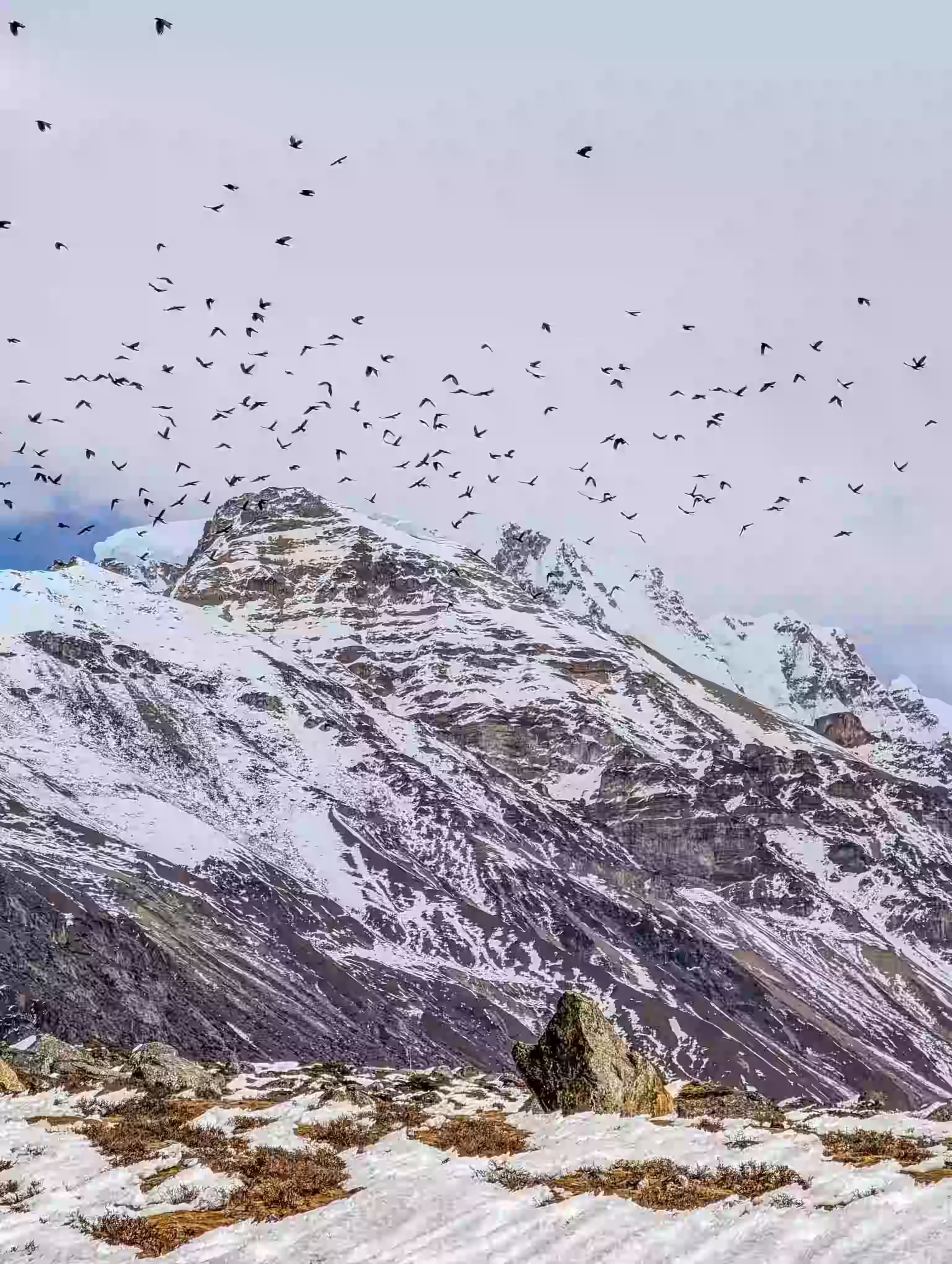
Most trekking routes show you one side of a mountain, but the 20-day Kanchenjunga Circuit Trek takes you to both its northern and southern sides. Your journey starts in the green hills of eastern Nepal before you enter the remote Kanchenjunga Conservation Area in Taplejung. As you climb higher, forests and river valleys slowly change into rocky trails, high pastures, and glacial landscapes.

You first follow the northern route through Ghunsa, Kambachen, and Lhonak to Pangpema, the Kanchenjunga North Base Camp. After returning to Ghunsa, you cross Sele Le and continue through Cheram and Ramche to the southern viewpoint at Oktang. By the end of the trek, you see two very different sides of Kanchenjunga, the world’s third-highest mountain.

Trip Info 

  • Sekathum, after driving from Taplejung through Rani Pul
  • Rani Pul, followed by a drive to Taplejung
  • Approx. 145 to 165 km / 74 to 81 miles, depending on acclimatization hikes, trail conditions, and route changes
  • Trekking/Hiking + Domestic Flights + Scenic Drives
  • Challenging
  • March to May and September to November
  • Pangpema, Kanchenjunga North Base Camp, approximately 5,140m / 16,864ft
  • 4 to 8 hours
  • Restricted Area Permit, Kanchenjunga Conservation Area Permit, and e-TIMS registration
  • Hotels in Kathmandu and Taplejung; basic teahouses and local lodges during the trek
  • Breakfast, lunch, and dinner during the trek
  • Licensed guide and porter available; 1 porter for 2 trekkers

Why Trek to the Kangchenjunga Circuit

The Kanchenjunga Circuit Trek gives you a complete journey around one of Nepal’s most remote mountain regions. Unlike routes that end at one viewpoint, this circuit takes you to both Pangpema on the northern side and Oktang on the southern side. You see Kanchenjunga from two different valleys while following a quieter trail through eastern Nepal.

Your surroundings change throughout the trek. You walk beside fast-flowing rivers, cross forested hills, visit remote villages, and continue into wide glacial valleys below some of the highest peaks in the Himalayas. Acclimatization days in Ghunsa and Kambachen also give you time to adjust before you reach the higher sections of the route.

Trek Highlights 

  • Explore the protected landscapes of the Kanchenjunga Conservation Area.
  • Travel through the tea-covered hills of Fikkal and Kanyam before entering the mountain region.
  • Trek through Ghunsa, Kambachen, Lhonak, Sele Le, Cheram, and Ramche.
  • Reach Pangpema, the Kanchenjunga North Base Camp, at approximately 5,140m / 16,864ft.
  • Visit the Oktang viewpoint on the southern side of the Kanchenjunga range.
  • See the northern and southern faces of Kanchenjunga during one complete circuit.
  • Cross the remote Sele Le section between the northern and southern valleys.
  • Spend acclimatization days in Ghunsa and Kambachen before moving higher.
  • Walk through forests, river valleys, alpine pastures, rocky moraine, and glacial terrain.

Tour Plan

Your 20-day journey begins when you arrive at Tribhuvan International Airport in Kathmandu. Our team welcomes you at the airport and drives you to your hotel. After check-in, you rest, settle into your room, and recover from your international flight.

Later, you meet your guide for a full trek briefing. Your guide explains the route, permits, flights, road transfers, accommodation, meals, altitude plan, and daily walking schedule. You also check your gear and prepare your day bag for the flight to Biratnagar.

  • Trip duration: 25 to 30 minutes taxi ride from the airport to your hotel

  • Drive distance: 5 to 7 km / 3.1 to 4.3 miles, depending on the hotel location

Note: Keep your passport, insurance documents, passport-size photos, and flight details ready for the permit process.

After an early breakfast, you take a morning domestic flight from Kathmandu to Biratnagar, a major city located in the low Terai plains of southeastern Nepal. Upon landing, a private vehicle picks you up to begin the long, winding drive north into the foothills of the eastern Himalayas.

The road leaves the warm southern plains and climbs steadily through the terraced hills of Ilam and Panchthar. You pass vast cardamom fields and small mountain trading towns before arriving late in the evening at Taplejung Bazaar (Phungling Municipality), the main entryway to the Kanchenjunga wilderness.

  • Flight duration: Around 45 minutes

  • Drive duration: 8 to 9 hours

  • Drive distance: 230 to 250 km / 143 to 155 miles

  • Maximum altitude: 1,820m / 5,971ft

  • Elevation gain: +1,740m / +5,971ft

Note: Domestic flight times may change due to weather or operational conditions. Also, buy any last-minute supplies here because services become more limited after you leave Taplejung.

With your final supplies packed in Taplejung, you leave the district center and drive toward Rani Pul. The rough road descends through scattered villages and forested slopes before entering the Tamor River valley. As the landscape becomes more remote, you reach Rani Pul, where the drive ends and your trek begins.

After lunch, you start with an easy 2 to 3-hour walk to Sekathum. The trail follows the river, crosses suspension bridges, and passes small terraced fields as the valley gradually narrows. By late afternoon, you reach Sekathum and settle into a local teahouse for the night.

  • Drive Duration 3 to 4 hours

  • Drive Duration 70 km / 43.5 miles

  • Trek duration: 2 to 3 hours

  • Trek distance: 10 km / 6.2 miles

  • Maximum altitude:1,820m / 5,971ft (Taplejung)

  • Net Elevation loss: -170m / -558ftm

Note: This is your first trekking day and includes steady altitude gain, so walk slowly and avoid rushing.

Your first full trekking day begins with a river crossing outside Sekathum. From there, the trail follows the Ghunsa Khola through a tight gorge filled with bamboo, rhododendron, stone steps, and several small bridges. You pass small settlements such as Jognim and Ghaiyabari as the route moves away from the lower river area.

A long uphill climb leads you out of the gorge and toward Amjilosa, a small hillside settlement surrounded by forest. The large elevation gain makes this a demanding start to the walking route, so you keep a steady pace and take regular breaks before reaching your teahouse.

  • Trek duration: 6 to 7 hours

  • Trek distance: 10 km / 6.2 miles

  • Maximum altitude: 2,510m / 8,235ft

  • Net Elevation gain: +910m / +2,986ft

Note: Keep a steady pace, drink water regularly, and use trekking poles on the steeper parts.

After the steep climb to Amjilosa, the trail continues at a gentler pace through the upper Ghunsa Khola valley. You walk beneath bamboo, oak, rhododendron, and fir trees, with waterfalls appearing between the forested slopes. Short climbs and descents lead you toward Thyangyam, a small stop along the route.

Beyond Thyangyam, the path rises steadily through the quiet forest before reaching Gyabla, also known as Kyapra. This small mountain settlement sits above the river valley and offers a peaceful place to rest.

  • Trek duration: 4 to 5 hours

  • Trek distance: 5 to 6 km / 3.1 to 3.7 miles

  • Maximum altitude: 2,730m / 8,956ft

  • Elevation gain: +220m / +722ft

Note: Forest sections can stay damp and slippery, especially after rain. Walk carefully on moss-covered steps and wooden paths.

Leaving Gyabla, you descend toward the river and then continue through pine and larch forests. The tight gorge gradually opens into a broad glacial valley as you climb above 3,000m / 9,843ft. On the way, you pass Phole, a Tibetan refugee camp known for its wooden monastery, handwoven rugs, and traditional mountain life.

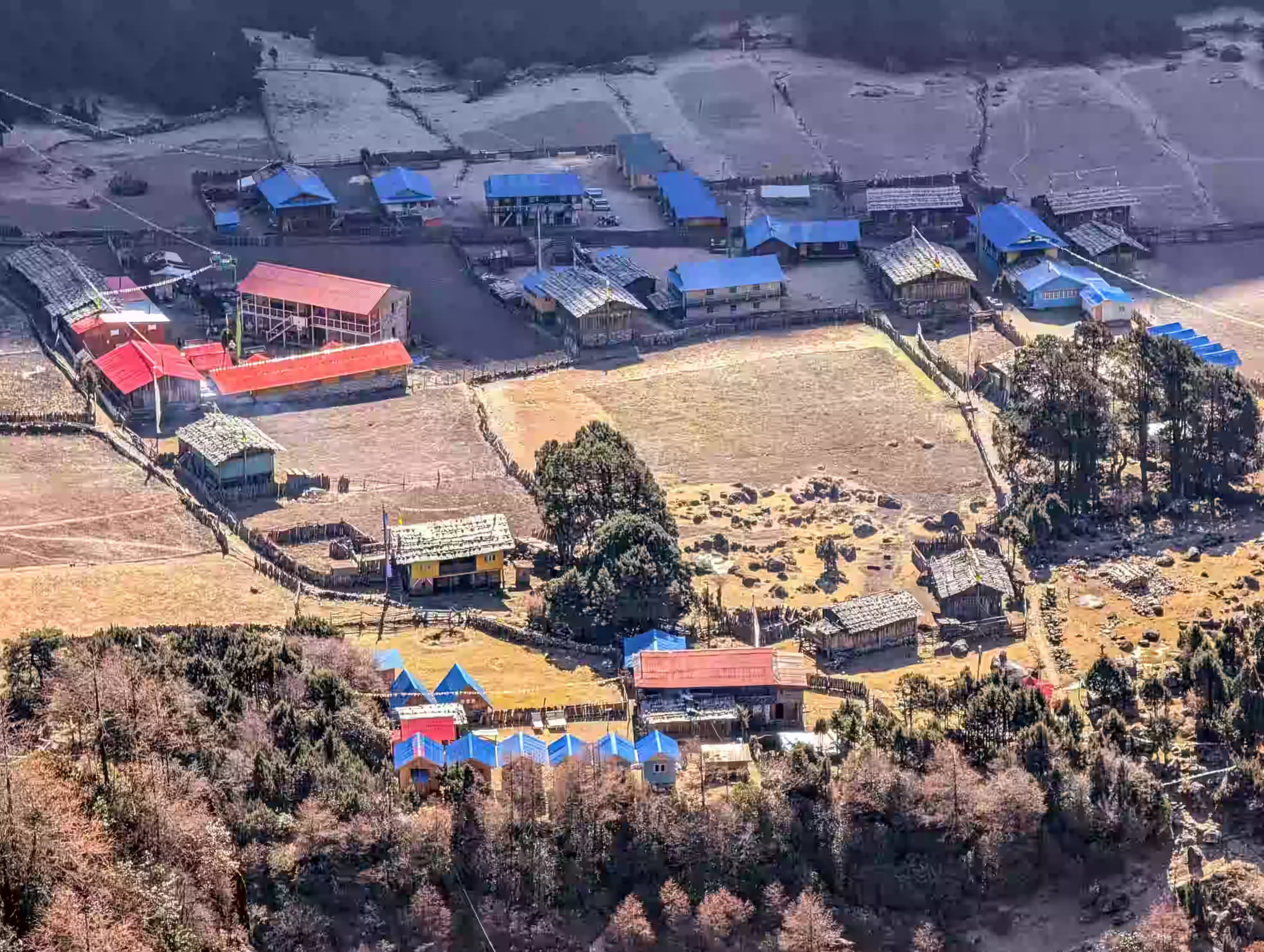
After crossing the Ghunsa Khola, you enter Ghunsa, one of the main villages on the northern Kanchenjunga route. Wooden houses, prayer flags, cultivated fields, and forested slopes surround your overnight stop.

  • Trek duration: 5 to 6 hours

  • Trek distance: 11 km / 6.8 miles

  • Maximum altitude: 3,430m / 11,401ft

  • Elevation gain: +745m / +2,444ft

Note: Your sleeping altitude rises sharply on this stage. Walk slowly, drink enough water, and report any signs of altitude sickness to your guide.

Instead of moving to the next village, you stay in Ghunsa and give your body a full day to adjust. Your morning starts with a steady hike to a ridge above the village. The steady ascent helps your body adjust while giving you broader views across the Ghunsa Valley.

From the upper viewpoint, you see Kumbhakarna, also known as Jannu, rising above the surrounding ridges. After taking time at the viewpoint, you descend to Ghunsa for lunch and a relaxed afternoon and prepare your warmer gear for the route to Kambachen.

  • Trek duration: 4 to 5 hours

  • Trek distance: 5 to 7 km / 3.1 to 4.3 miles

  • Maximum altitude: 3,990m / 13,091ft

  • Elevation gain/loss: +425m / +1,394ft and -425m / -1,394ft

Note: Keep the hike slow and comfortable. Return to the village immediately if you develop a headache, nausea, dizziness, or unusual tiredness.

After your two-night stay in Ghunsa, you follow the Ghunsa Khola toward the upper valley. Larch and juniper forests line the early section, but the trees become thinner as you climb. The trail then crosses a large landslide area filled with loose rocks and boulders.

The rough trail leads into a broad glacial valley surrounded by steep rock walls and snowy peaks. Kambachen sits inside this open mountain basin, with clear views toward Mount Jannu.

  • Trek duration: 5 to 6 hours

  • Trek distance: Approximately 10 km / 6.2 miles

  • Maximum altitude: Tserko Ri, 5,033m / 16,512ft or Kyanjin Ri, 4,773m / 15,659ft

  • Elevation gain: +455m / +1,493ft

Note: The landslide section becomes loose or icy depending on the season. Cross it slowly and avoid stopping beneath unstable slopes.

Instead of climbing straight to Lhonak, you remain in Kambachen for one more night. A morning hike leads you through a rocky glacial valley toward Kumbhakarna (Jannu) Viewpoint. From the higher ground, you can see the steep face of Jannu and the surrounding snow-covered peaks.

After spending time at the viewpoint, you follow the same trail back to Kambachen. Use the time to rest, drink enough water, and prepare your warm layers for the colder trail ahead.

  • Hike duration: 4 to 5 hours

  • Hike distance: Approximately 8 km / 5 miles round trip

  • Maximum altitude: 4,420m / 14,501ft

  • Elevation gain/loss: +370m / +1,214ft, then -370m / -1,214ft

Note: Snow, wind, or poor visibility changes the hiking route. Follow your guide’s advice and return early if you feel unwell.

With your body better adjusted after two nights in Kambachen, you begin the climb toward Lhonak. You walk toward Ramtang and follow the moraine above the glacier, where the trail crosses rocky slopes and small frozen streams.

Lhonak appears at the far end of a broad, barren plateau. The settlement has only a handful of simple lodges and feels completely cut off from the villages below. The area also provides habitat for snow leopards, but spotting one is very uncommon.

  • Trek duration: 5 to 6 hours

  • Trek distance: 9 km / 5.6 miles

  • Maximum altitude: 4,780m / 15,682ft

  • Elevation gain: +730m / +2,395ft

Note: Lhonak feels very cold after sunset. Keep your down jacket and other warm layers within easy reach.

From Lhonak, you head across a stark landscape shaped by the Kanchenjunga Glacier. Rock, ice, and steep mountain walls dominate the route, while Tent Peak and Chang Himal rise above the valley.

The trail ends at Pangpema, where you stand below the northern side of Kanchenjunga. The base camp has no permanent lodge, so you pause for views and then return along the same trail. You finish the day back in Lhonak at a lower sleeping altitude.

  • Trek duration: 7 to 8 hours

  • Trek distance: Approximately 14 to 15 km / 8.7 to 9.3 miles round trip

  • Maximum altitude: 5,140m / 16,864ft

  • Elevation gain: +360m / +1,181ft and -360m / -1,181ft

Note: No food or lodging services are available along the route. Carry enough water, snacks, warm layers, sun protection, and essential medicines for the full return hike.

With the northern base camp visit complete, you begin the return journey through the upper Kanchenjunga Valley. The trail passes Ramtang and Kambachen before dropping steadily toward Ghunsa.

The scenery changes as you move down the valley. Bare slopes slowly give way to shrubs and forest, while blue sheep or other mountain wildlife may appear along the way. Ghunsa welcomes you back with wooden homes, prayer flags, and a quiet monastery.

  • Trek duration: 7 to 8 hours

  • Trek distance: Approximately 21 to 22 km / 13 to 13.7 miles

  • Maximum altitude: 4,780m / 15,682ft (starting point, Lhonak)

  • Elevation loss: -1,305m / -4,281ft

Note: Long downhill sections strain your knees, so use trekking poles and avoid rushing.

After resting in Ghunsa, you leave the familiar river valley and begin a steep climb toward Sele Le. The trail rises through rhododendron, pine, and juniper forest, with very few flat sections. As you gain height, the trees become thinner and wider views open across the surrounding ridges.

Sele Le is a small and exposed high camp that connects the northern and southern Kanchenjunga routes. Its basic teahouses provide a simple place to eat and sleep before the long pass crossing to Cheram

  • Trek duration: 4 to 5 hours

  • Trek distance: Approximately 8 to 9 km / 5 to 5.6 miles

  • Maximum altitude: 4,200m / 13,780ft

  • Elevation gain: +725m / +2,379ft

Note: Sele Le is colder and more exposed than Ghunsa. Keep your down jacket, gloves, headlamp, water, and windproof layers ready for the high passes on the following morning.

Your night at Sele Le marks the end of the northern side of the circuit. You start early and climb across a chain of high ridges, passing Sinion La, Mirgin La, and Sinelapche Bhanjyang. On a clear morning, the open trail offers distant views of Kanchenjunga, Kumbhakarna, Makalu, and the mountains along Nepal’s eastern border.

The route repeatedly rises and falls before reaching its highest point at Sinelapche Bhanjyang. From the final ridge, you begin a long and steep descent toward the southern valley. The rocky slopes slowly give way to alpine vegetation before you reach Cheram, a small lodge settlement near the Simbuwa Khola.

  • Trek duration: 7 to 8 hours

  • Trek distance: Approximately 12 to 14 km / 7.5 to 8.7 miles

  • Maximum altitude: 4,646m / 15,243ft (Sinelapche Bhanjyang)

  • Elevation gain/loss: Approximately +446m / +1,463ft, followed by -776m / -2,546ft

Note: Wind, snow, or fog makes navigation difficult across the passes. Stay close to your guide

Leaving Cheram, you climb through open alpine meadows toward Ramche, the last overnight stop on the southern route. The trail follows the Yalung Glacier valley, with views of Rathong, the Kabru range, and other snow-covered peaks appearing above the ridges. After reaching Ramche, you continue across rocky ground toward Oktang.

Oktang offers a close view of Kanchenjunga’s southern face and the wide Yalung Glacier below. After spending time at the viewpoint, you return to Ramche and settle into a basic mountain lodge.

  • Trek duration: 6 to 7 hours

  • Trek distance: Approximately 13 to 14 km / 8.1 to 8.7 miles

  • Maximum altitude: 4,740m / 15,551ft (Oktang)

  • Elevation gain/loss: +870m / +2,854ft, followed by -160m / -525ft

Note: Start early and carry a packed lunch, enough water, and warm layers as clouds and wind can reduce visibility around Oktang later in the day.

After your night in Ramche, you leave the open alpine valley and begin a steep descent toward lower ground. The trail passes Cheram before turning into thick rhododendron and pine forest inside the Kanchenjunga Conservation Area. As the landscape becomes greener, you may spot Himalayan monals, barking deer, or signs of red pandas.

The route includes stone steps, sharp switchbacks, slippery sections, and a few landslide-prone areas. You reach Torongding, a quiet forest settlement with only a small number of basic teahouses and limited services.

  • Trek duration: 5 to 6 hours

  • Trek distance: Approximately 16 km / 10 miles

  • Maximum altitude: 4,580m / 15,026ft (starting point, Ramche area)

  • Elevation loss: -1,600m / -5,249ft

Note: Charging costs extra, and internet service is unavailable in Torongding, so carry enough cash.

Your final full walking stage begins with a steady descent from Torongding. The trail moves through bamboo, subtropical forest, and large cardamom plantations as the valley becomes warmer.

Farther down, the path passes Limbu and Chhetri villages, surrounded by terraces and small farms. By afternoon, you reach Rani Pul, where the trekking trail meets the road again.

  • Trek duration: 7 to 8 hours

  • Trek distance: Approximately 20 to 22 km / 12.4 to 13.7 miles

  • Maximum altitude: 2,980m / 9,777ft (starting point, Torongding)

  • Elevation loss: -1,550m / -5,085ft

Note: Use trekking poles on the downhill sections, as the long elevation loss puts pressure on your knees.

With the walking route behind you, the journey shifts back to road travel. A local jeep carries you from Rani Pul through Taplejung and Panchthar, passing river valleys, farming villages, and forested ridges. The long drive gives you one last look at the remote landscape of eastern Nepal.

By evening, you arrive in Kanyam, where tea gardens cover the surrounding slopes. The hotel offers more comfort than the basic lodges on the trail, so you enjoy a warm shower, charge your devices, and rest after the long journey.

  • Trek duration: 7 to 8 hours

  • Trek distance: Approximately 160 km / 99.4 miles

  • Maximum altitude: 1,820m / 5,971ft (Taplejung)

Note: Keep your valuables, water, medicines, and electronics in your day bag during the drive.

After breakfast in Kanyam, you leave the tea-covered hills and drive toward Bhadrapur. The road passes Fikkal and descends into the warmer plains of Jhapa before reaching Chandragadhi Airport.

From Bhadrapur, you take a direct flight back to Kathmandu. Our team meets you at the airport and takes you to your hotel. In the evening, a farewell dinner is arranged to celebrate the completion of your Kanchenjanga Circuit Trek.

  • Drive duration: 1.5 to 2 hours

  • Drive distance: Approximately 50 km / 31 miles

  • Flight durationss: 45 minutes

Note: Carry essential items in your hand luggage in case your checked bag arrives later or the flight schedule changes.

Your 20-day Kanchenjanga Circuit Trek concludes in Kathmandu. Our team picks you up from your hotel and drives you to Tribhuvan International Airport based on your flight schedule.

If your flight leaves later, you get time to shop for souvenirs or take a short walk around the city. You return home with lasting memories of Pangpema, the Sele Le passes, the Yalung Valley, remote mountain villages, and the changing landscapes of eastern Nepal.

  • Drive duration: 25 to 30 minutes

  • Drive distance: 5 to 7 km / 3.1 to 4.3 miles, depending on the hotel location

Note: Arrive at the airport at least 3 hours before your international flight.

Cost Includes

Cost Excludes

Trekking Feasibility
Calculating...
Projections represent historical trends and general seasonal elevation conditions.
Route Stop & Elevation
Daytime (Sunny)
Nighttime (Cold)

Note: These temperatures represent the peak trekking seasons (Spring from March to May and Autumn from September to November). High-altitude weather can change rapidly.

The best time for the Kanchenjunga Circuit Trek is during spring from March to May and autumn from September to November. Spring brings mild daytime temperatures, blooming rhododendrons, and clearer access to the higher valleys. Autumn offers dry trails, stable weather, and clear views of Kanchenjunga, the Sele Le ranges, and the Yalung Glacier.

Winter brings severe cold to Pangpema, Sele Le, Cheram, and the other high sections of the route. Snow often makes the passes and base camp trails harder to cross. Monsoon is less suitable because heavy rain affects roads, causes landslides, creates muddy trails, and blocks mountain views.

Accommodation on the Kanchenjunga Circuit Trek ranges from comfortable hotels to basic mountain teahouses. Hotels in Kathmandu, Kanyam, and Taplejung offer private rooms and better facilities, while trail lodges provide simple beds and shared bathrooms. Rooms and services become very limited at Lhonak, Sele Le, Ramche, and Torongding.

The lower route around Taplejung and Rani Pul reflects the food traditions of the Limbu community. Local specialties include kinema, a fermented soybean dish, and dhindo served with gundruk or seasonal vegetables. These dishes depend on local ingredients and do not appear on every teahouse menu.

Food takes on a stronger Tibetan influence around Ghunsa and the higher valleys. Common local choices include thukpa, Tibetan bread, butter tea, tsampa, and yak cheese or churpi. Carry energy bars, nuts, chocolate, and electrolyte powder for Pangpema, the Sele Le crossing, and other sections without reliable meal stops.

The Kanchenjunga Circuit Trek is challenging. You walk for 5 to 8 hours on most days across steep climbs, long descents, rocky moraine, forest trails, and exposed high passes. The remote route also gives you fewer rest stops and basic facilities.

Altitude adds another major challenge. You sleep above 4,000m / 13,123ft in Kambachen, Lhonak, Sele Le, and Ramche, while Pangpema reaches about 5,140m / 16,864ft. However, two acclimatization days, slow pacing, proper hydration, and enough rest help your body adjust.

You need good fitness, strong legs, and previous hiking experience for this trek. Although you do not need technical climbing skills, you must feel comfortable with long days, cold weather, basic lodges, and remote mountain conditions.

The Kangchenjunga Circuit Trek takes you through warm lower valleys, cold high-altitude villages, windy passes, and remote mountain trails. Pack light, but carry enough warm layers and trekking gear for changing weather and long walking days.

Plan Your Kanchenjanga Circuit Trek with Us!

Ready to explore Ghunsa, Pangpema, Sele Le, Ramche, and both sides of Kanchenjunga? Get in touch with Joyful Eco Treks to plan your 20-day Kanchenjunga Circuit Trek with proper permits, safe acclimatization, licensed guide support, and complete trip planning from arrival to departure.

Frequently Asked Question

How long does the Kanchenjunga Circuit Trek take?

The Kanchenjunga Circuit Trek usually takes 19 to 25 days. This package follows a 20-day itinerary with two acclimatization days, domestic flights, road transfers, and visits to both sides of Kanchenjunga.

The Kanchenjunga Circuit Trek covers approximately 150 to 180 km / 93 to 112 miles on foot. The total distance changes according to side hikes, lodge locations, trail conditions, and the selected starting point.

This Kanchenjunga Circuit Trek starts with a flight from Kathmandu to Bhadrapur and road travel through Kanyam and Taplejung. The walking section begins from Rani Pul and continues toward Sekathum.

Pangpema, the Kanchenjunga North Base Camp, is the highest point of the Kanchenjunga Circuit Trek itinerary at approximately 5,140m / 16,864ft.

April, May, October, and November are the best months for the Kanchenjunga Circuit Trek. These months usually offer clearer skies, stable weather, and better trail conditions.

No, the full Kanchenjunga Circuit Trek is not suitable for complete beginners. You need good fitness, multi-day hiking experience, and confidence on steep, remote, and high-altitude trails.

Yes, basic teahouses are available at the main overnight stops. Facilities become limited in remote places such as Lhonak, Sele Le, Ramche, and Torongding.

The Kanchenjunga Circuit Trek cost depends on group size, trip length, domestic flights, transport, permits, hotels, meals, guide service, and porter support. Share your travel dates and group size with the trekking company for the exact package price.

Yes, you need a licensed guide for the Kanchenjunga Circuit Trek. The route enters a restricted trekking area, so permits and guide arrangements must go through a registered trekking agency.

You need a Kanchenjunga Restricted Area Permit, a Kanchenjunga Conservation Area Permit and e-TIMS registration for the Kanchenjunga Circuit Trek. Your trekking agency arranges these permits before the trek begins.

A shorter Kanchenjunga trek usually covers either the north or south base camp route. The complete circuit needs more time because it includes high-altitude acclimatization, the Sele Le crossing, and long travel between Kathmandu and Taplejung.

The Kanchenjunga Circuit Trek shows you both the northern and southern sides of the world’s third-highest mountain. The route also combines remote villages, glacial valleys, high passes, quiet trails, and protected landscapes in eastern Nepal.

Ready to Trek the Kanchenjunga Circuit?

Send us your travel dates, group size, and trekking background. We will help you plan the full 20-day Kanchenjunga Circuit Trek with domestic flights, private transfers, licensed guides, proper acclimatization, and clear cost details.