Kanchenjunga South Base Camp Trek 12 Days | Cost Joyful Eco Treks | Nepal’s Best Trek and Tours Packages

Kanchenjunga South Base Camp Trek: 12 Days Complete Itinerary and Guide

Annapurna, Gandaki Province, Nepal

12 Days

Trek Region

Annapurna / Nar Phu Valley

Group Size

1-12 trekkers (Private & Small Group)

The Kangchenjunga or Kanchenjunga South Base Camp Trek follows a remote route through the eastern hills of Nepal to the southern side of Mount Kanchenjunga. At 8,586m / 28,169ft, Kanchenjunga is the third-highest mountain in the world. The trail passes Limbu and Rai settlements, terraced farmland, bamboo and rhododendron forests, river valleys, alpine meadows, glacial moraine, and the upper Yalung Glacier area.

This 12-day Kanchenjunga Base Camp Trek begins with a flight from Kathmandu to Biratnagar and a private jeep journey to Taplejung. The walking route continues through Yamphuding, New Jhoroni, Cheram, Ramche, and Oktang Viewpoint before descending through Torongding. The trip ends with road travel through Fikkal and a flight from Bhadrapur to Kathmandu.

Trip Info 

  • Rani Pul, after flying to Biratnagar and driving by private jeep
  • Rani Pul, followed by a drive to Fikkal
  • Approximately 95 to 105 km / 59 to 65 miles
  • Trekking, hiking, domestic flights, and mountain road travel
  • Challenging to strenuous
  • March to May and September to November
  • Oktang Viewpoint, approximately 4,730m / 15,518ft
  • 5 to 8 hours
  • Kanchenjunga Restricted Area Permit, Kanchenjunga Conservation Area Permit, and TIMS card under the current trekking rules
  • Hotels in Kathmandu, Taplejung, and Fikkal; local teahouses during the trek
  • Breakfast, lunch, and dinner during trekking days
  • A licensed trekking guide is required. Porter service is available, normally with one porter shared by two trekkers.

Why Choose the Kanchenjunga South Base Camp Trek?

The Kanchenjunga South Base Camp Trek is suited to trekkers who want a quiet Himalayan route with fewer visitors than the Everest and Annapurna trails. It reaches the Yalung Glacier side of Kanchenjunga without completing the longer circuit through the North Base Camp and high passes.

The trek also combines the rural culture of eastern Nepal with a quick transition into high mountain terrain. Moreover, Yamphuding and the lower settlements introduce local farming life, while Cheram, Ramche, and Oktang bring you close to glaciers, moraine, ice-covered ridges, and the south face of Kanchenjunga.

Trek Highlights 

  • Reach Oktang Viewpoint at approximately 4,730m / 15,518ft.
  • Walk toward the southern base of Mount Kanchenjunga, the world’s third-highest mountain.
  • See the Yalung Glacier and the upper Kanchenjunga valley.
  • Spend a night at Ramche at approximately 4,580m / 15,026ft.
  • Follow a remote trail through Yamphuding, New Jhoroni, Cheram, and Torongding.
  • Walk through bamboo, oak, pine, and rhododendron forests.
  • Experience the Limbu and Rai villages in eastern Nepal.
  • See Kanchenjunga, Yalung Kang, Kabru, Rathong, Talung, and nearby summits when weather permits.
  • Pass waterfalls, streams, suspension bridges, alpine meadows, and glacial moraine.
  • Complete a shorter southern route without crossing the high passes of the full Kanchenjunga Circuit.
  • Travel across the tea-growing hills of Fikkal and Ilam.
  • Trek inside the Kanchenjunga Conservation Area.
  • Stay in small mountain teahouses along a lightly visited route.
  • Travel with a licensed guide through one of Nepal’s restricted trekking regions.

Tour Plan

You arrive at Tribhuvan International Airport, where our team welcomes you and transfers you to your hotel in Kathmandu. After checking in, you can rest from the international journey or walk around the nearby streets of Thamel.

Later, you meet your guide for a briefing about the Kanchenjunga South Base Camp Trek itinerary. The guide covers domestic flights, jeep transfers, permits, accommodation, meals, expected trail conditions, packing, altitude safety, and the daily walking plan.

  • Trip duration: 25 to 30 minutes, vehicle ride from the airport to the hotel

  • Drive distance: Approx. 6 km / 3.7 miles

  • Maximum altitude: Kathmandu, approximately 1,400m / 4,593ft

Note: Keep your passport, Nepal visa, travel insurance, and passport-size photographs ready for permit processing.

You take a morning domestic flight from Kathmandu to Biratnagar in the eastern plains of Nepal. The flight normally takes around 35 to 40 minutes and provides a quick connection between Kathmandu Valley and Koshi Province.

After landing, you meet the jeep driver and begin the long road journey to Taplejung. The road leaves the flat Terai and climbs through river valleys, market towns, terraced hills, forested ridges, and winding mountain roads before reaching Taplejung.

  • Flight duration: 35 to 40 minutes

  • Flight distance: Approx. 232 km / 144 miles

  • Drive duration: 7 to 9 hours

  • Drive distance: Approx. 210 to 245 km / 130 to 152 miles

  • Maximum altitude: Taplejung, approximately 1,820m / 5,971ft

Note: This is a long travel day. Flight timing, traffic, rain, road repairs, and landslides may affect the arrival time.

The day starts with a drive from Taplejung toward Rani Pul, passing hill roads, terraced farms, and small settlements. Rani Pul works as the road access point before the walking section begins. From there, you start the trail toward Yamphuding through green hills, village paths, and farmland.

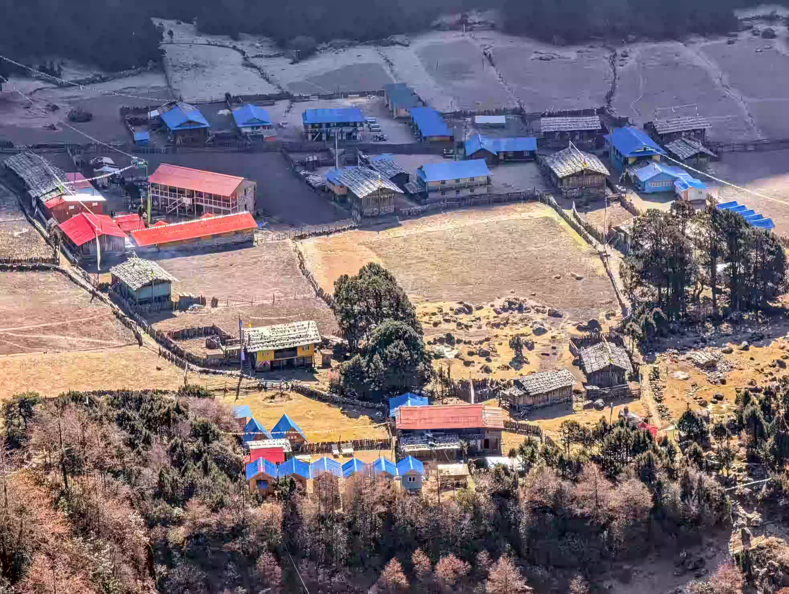
Yamphuding is an important stop on the southern approach to Kanchenjunga. The village gives you your first real feel of the lower mountain communities before the route climbs higher. You reach Yamphuding, a large village surrounded by terraced fields, forested slopes, and river valleys.

  • Drive duration: 3 to 4 hours

  • Drive distance: Approx. 65 to 70 km / 40 to 43.5 miles

  • Trek duration: 2 to 3 hours

  • Trek distance: Approx. 6 to 8 km / 3.7 to 5 miles, based on the exact road drop-off point

  • Maximum altitude: Yamphuding, 2,080m / 6,824ft

  • Elevation gain: +280m / +919ft

Note: Confirm the exact walking trail and jeep-access point with the operations team before departure, as road access in the lower Kanchenjunga region can change.

You leave the cultivated hills around Yamphuding and enter a quieter forest route. The path passes small streams, wooden bridges, damp forest sections, and slopes covered with bamboo, oak, and rhododendron.

The trail rises steadily toward New Jhoroni, a small overnight stop within the Kanchenjunga Conservation Area. Facilities are basic, but the forest setting provides a peaceful place to rest before the steeper climb toward Cheram.

  • Trek duration: 5 to 6 hours

  • Trek distance: Approx. 17 to 18 km / 10.6 to 11.2 miles

  • Maximum altitude: New Jhoroni, 2,700m / 8,858ft

  • Elevation gain: Approx. +620m / +2,034ft

Note: Forest trails may become muddy and slippery after rain, so keep rain gear and trekking poles within easy reach.

You continue uphill through rhododendron, pine, oak, and bamboo forests. Waterfalls and small streams run down the surrounding slopes, while the vegetation becomes thinner as the route gains height.

The final section leads into colder alpine terrain before reaching Cheram, also written as Tseram. The large altitude gain makes this one of the harder days of the itinerary, so the group walks slowly and takes regular breaks.

  • Trek duration: 6 to 7 hours

  • Trek distance: Approx. 14 to 15 km / 8.7 to 9.3 miles

  • Maximum altitude: Cheram, 3,870m / 12,697ft

  • Elevation gain/ loss: Approx. +1,170m / +3,839ft

Note: Report headaches, nausea, dizziness, poor coordination, or unusual tiredness to your guide after reaching Cheram.

You spend the day at Cheram so your body can adjust before moving above 4,000m / 13,123ft. The morning can be kept relaxed, with enough time for hydration, warm meals, gear checks, and rest.

Depending on the weather and group conditions, your guide may lead a short hike above the settlement before returning to Cheram. Gaining some height during the day and sleeping at the same lodge supports acclimatization for the walk toward Ramche and Oktang.

  • Optional hike duration: 2 to 4 hours

  • Optional hike distance: Approx. 3 to 6 km / 1.9 to 3.7 miles

  • Maximum altitude: Approx. 4,100m to 4,300m / 13,451ft to 14,108ft

  • Elevation gain/loss: Approx. +250m to +430m / +820ft to +1,411ft

Note: A rest day does not mean remaining in bed all day. A slow acclimatization walk is useful when weather and health permit.

You leave Cheram early and follow the upper Yalung Valley toward Ramche. The forest gradually disappears as the path enters open alpine ground, rocky moraine, glacial terrain, and broad mountain basins surrounded by snow-covered ridges.

From Ramche, you continue toward Oktang Viewpoint, commonly treated as the Kanchenjunga South Base Camp viewpoint. After spending time near the Yalung Glacier and viewing the southern side of Kanchenjunga, you return to Ramche for the night.

  • Trek duration: 6 to 8 hours

  • Trek distance: Approx. 14 to 16 km / 8.7 to 10 miles

  • Maximum altitude: Oktang Viewpoint, approximately 4,730m / 15,518ft

  • Elevation gain/loss: Approx. +860m / +2,822ft; Approx. -150m / -492ft

Note: Walk slowly above Ramche and inform your guide immediately if you experience a worsening headache, vomiting, confusion, breathlessness at rest, or trouble walking.

You may wake early for another look at the high peaks before beginning the long descent. The trail returns through the open valley toward Cheram and then drops into thicker rhododendron, pine, and bamboo forests.

The route continues beside streams and waterfalls until you reach Torongding, also written as Tortong. Although breathing becomes easier as you lose height, the long downhill sections can place pressure on the knees and thighs.

  • Trek duration: 5 to 7 hours

  • Trek distance: Approx. 15 to 16 km / 9.3 to 10 miles

  • Maximum altitude: Ramche, 4,580m / 15,026ft

  • Elevation loss: Approx. -1,600m / -5,249ft

Note: Use trekking poles and avoid rushing down wet stone, loose soil, tree roots, or steep forest steps.

You continue descending through forested slopes, river crossings, and lower hill terrain. The air becomes warmer as you leave the alpine zone and return toward cultivated land and permanent villages.

After several climbs and descents, the trail reaches Yamphuding. You spend the final trekking night here and can rest with your guide and porter team after completing the high section of the route.

  • Trek duration: 5 to 6 hours

  • Trek distance: Approx. 16 to 17 km / 10 to 10.6 miles

  • Maximum altitude: Torongding, 2,980m / 9,777ft

  • Elevation loss: Approx. -900m / -2,953ft

Note: The change from cold alpine conditions to warmer lower forests can be noticeable, so adjust your clothing during the descent.

You leave Yamphuding by jeep and travel through the rural hills of eastern Nepal. The route passes farms, forests, roadside settlements, river valleys, and sections of rough mountain road before joining better roads toward Ilam.

You continue to Fikkal, close to the tea-growing area of Kanyam. After checking into the hotel, you can rest, take a short walk, or enjoy views across the green tea-covered hills.

  • Drive duration: 5 to 7 hours

  • Drive distance: Approx. 130 to 160 km / 81 to 99 miles

  • Maximum altitude: -528m / -1,732ft

  • Elevation loss: Yamphuding, 2,080m / 6,824ft

Note: The journey time depends on the jeep pickup point, road condition, landslides, local traffic, and ongoing road work.

You drive from Fikkal through the tea-growing hills and descend toward Bhadrapur Airport. The road passes Kanyam, market areas, forested slopes, and the warmer plains of Jhapa District.

From Bhadrapur, you take a domestic flight to Kathmandu. After landing, our team transfers you to your hotel, where you can rest, arrange laundry, shop for souvenirs, book a spa session, or join a farewell dinner.

  • Drive duration: 2 to 3 hours

  • Drive distance: Approx. 60 to 70 km / 37 to 43 miles

  • Flight duration: 45 to 55 minutes

  • Elevation loss: Fikkal, approximately 1,500m / 4,921ft

Note: Domestic flights may be delayed by low visibility, storms, aircraft rotation, or airport traffic, so avoid booking an international connection on the same day.

Our team transfers you from your hotel to Tribhuvan International Airport according to your international flight schedule. The drive normally takes around 25 to 30 minutes, though traffic may add more time.

You leave Nepal with memories of Taplejung, Yamphuding, Cheram, Ramche, the Yalung Glacier, Oktang Viewpoint, and the remote southern side of Mount Kanchenjunga.

  • Trip duration: 25 to 30 minutes, vehicle ride to the airport

  • Driving distance: Approx. 6 km / 3.7 miles

Note: Reach the airport at least three hours before an international departure.

Cost Includes

Cost Excludes

Trekking Feasibility
Calculating...
Projections represent historical trends and general seasonal elevation conditions.
Route Stop & Elevation
Daytime (Sunny)
Nighttime (Cold)

Note: These figures are planning ranges for common spring and autumn conditions rather than daily forecasts. Temperature changes with the month, wind, cloud, rain, snowfall, sunlight, and time of day.

The best time for the Kanchenjunga Base Camp Trek is spring from March to May and autumn from September to November. Spring brings warmer lower trails, blooming rhododendrons, and longer daylight, while autumn usually brings clearer skies, dry paths, and sharp mountain views.

Winter, from December to February, is colder and may bring deep snow near Cheram, Ramche, and Oktang. The monsoon months from June to August bring heavy rain, leeches, muddy forest paths, cloud cover, landslides, and road delays in eastern Nepal.

The Kanchenjunga South Base Camp Trek is planned as a tea house trek, but facilities are more basic than those found on the Everest or Annapurna routes. Rooms normally have twin beds, simple mattresses, pillows, and blankets. Toilets are usually shared, while hot showers, Wi-Fi, electricity, and charging may be unavailable or cost extra.

Meals commonly include dal bhat, noodles, fried rice, potatoes, soup, momos, eggs, porridge, pancakes, chapati, and seasonal vegetables. Menus become smaller at higher stops, so it is wise to carry energy bars, nuts, electrolyte powder, and a few familiar snacks.

The Kanchenjunga Base Camp Trek difficulty is rated challenging to strenuous. The route includes long walking days, steep forest climbs, repeated descents, rough paths, high altitude, cold conditions, basic lodges, and limited access to medical care. The highest point reaches approximately 4,730m / 15,518ft.

Trekkers should train for at least six to eight weeks before the trip. Preparation should include long walks, stair climbing, hill hiking, cycling, running, and leg-strength work while carrying a 5 to 7 kg daypack. Previous multi-day trekking experience is strongly recommended for this compact itinerary.

Foreign trekkers need a Kanchenjunga Restricted Area Permit and a Kanchenjunga Conservation Area Permit. A TIMS card is also required under the current guided-trekking rules for listed Kanchenjunga routes.

The restricted-area permit must be arranged through a registered Nepali trekking agency. A licensed guide is required, and minimum group rules apply to foreign trekkers entering the restricted area. Permit requirements and fees should be checked again before each departure.

The route moves from the warm eastern plains to cold glacial terrain above 4,500m / 14,764ft. Pack moisture-wicking layers, dependable rain protection, warm clothing, and equipment suited to freezing nights.

Keep water, snacks, documents, medicine, a warm jacket, waterproof layers, and electronics in your daypack. Porters normally carry the main duffel bag.

Plan Your Kanchenjunga South Base Camp Trek with Us

Want to reach the southern base of the world’s third-highest mountain without the stress of handling permits, routes, and logistics alone? Joyful Eco Treks helps you plan the trek with a licensed guide, required permits, domestic flights, private transfers, teahouse stays, meals, porter support, and clear cost details before you travel.

Frequently Asked Question

Where is Kanchenjunga Base Camp located?

Mount Kanchenjunga lies in the eastern Himalayas on the border between Nepal and the Indian state of Sikkim. The Nepal-side South Base Camp route lies in Taplejung District inside the Kanchenjunga Conservation Area.

Oktang Viewpoint, commonly treated as the Kanchenjunga South Base Camp viewpoint, stands at approximately 4,730m / 15,518ft. Ramche, the highest overnight stop, is around 4,580m / 15,026ft. However, altitude figures vary slightly between maps and trekking operators because Ramche, the Yalung Glacier area, and Oktang are sometimes grouped under the general South Base Camp name.

Yes, the Kanchenjunga South Base Camp Trek is challenging to strenuous because of long walking days, steep climbs, high altitude, rough forest paths, cold weather, and limited lodge facilities. It does not require technical climbing, but trekkers need good cardiovascular fitness, strong legs, steady balance, and the ability to walk for five to eight hours on consecutive days.

A well-trained beginner with previous hill walking experience completes the trek more safely with a licensed guide. However, this route is not the best first Himalayan trek for someone with no hiking background. First-time trekkers should consider routes such as Annapurna Base Camp, Langtang Valley, or Mardi Himal before attempting a short and remote Kanchenjunga itinerary.

The full package of the trek to Kanchenjunga Base Camp takes 12 days from arrival to departure. The main walking section runs from Day 3 to Day 9 and includes one acclimatization day at Cheram. Longer Kanchenjunga treks covering the North Base Camp, South Base Camp, and high passes often take 20 to 26 days.

The estimated trekking distance for the Kanchenjunga Base Camp route is approximately 95 to 105 km / 59 to 65 miles. The final figure depends on the exact lower trailhead, acclimatization hike, route used near Ramche, and how far the group walks toward Oktang.

To reach Kanchenjunga Base Camp from Kathmandu, this itinerary uses a domestic flight from Kathmandu to Biratnagar, followed by a private jeep drive to Taplejung. The trek then follows the southern route through Yamphuding, New Jhoroni, Cheram, and Ramche. The return route descends through Torongding and Yamphuding before continuing by jeep to Fikkal and Bhadrapur. A domestic flight connects Bhadrapur with Kathmandu.

Short guided Kanchenjunga South Base Camp packages commonly cost around USD 1,300 to USD 1,900 per person. The final cost depends on group size, season, domestic airfare, private jeep use, hotel level, porter service, and package inclusions.

For the Kanchenjunga trek, foreign trekkers require a Kanchenjunga Restricted Area Permit and a Kanchenjunga Conservation Area Permit. A TIMS card is also required under the guided-trekking rules that apply to the listed Kanchenjunga routes. The restricted permit is processed through a registered Nepali trekking agency and cannot be arranged as an independent trekking permit.

No, foreign trekkers must travel through a registered trekking agency with a licensed guide because the Kanchenjunga region includes restricted areas. Independent trekking is not permitted on this route, and minimum foreign-trekker rules may apply to the permit group.

Yes, the Kanchenjunga Base Camp Trek is mostly a teahouse trek. Trekkers stay in basic mountain teahouses along the route, but facilities are simpler than in Everest or Annapurna. Rooms, meals, toilets, heating, and charging options remain limited in remote villages, so trekkers should expect a more basic and rugged teahouse experience.

March to May and September to November are the best periods for the Kanchenjunga South Base Camp Trek. These months usually provide safer trail conditions, working teahouses, manageable temperatures, and better mountain visibility.

Ready to Trek to Kanchenjunga South Base Camp?

Share your planned travel dates, group size, trekking background, and preferred services. Our team will arrange domestic flights, private jeeps, permits, hotels, teahouses, meals, a licensed guide, porter support, and the final trip price. Walk through the remote eastern hills of Nepal and reach the Yalung Glacier side of Mount Kanchenjunga with a route prepared around your schedule and trekking ability.