Kanchenjunga North Base Camp Trek 18 Days | Itinerary & Cost Joyful Eco Treks | Nepal’s Best Trek and Tours Packages

Kanchenjunga North Base Camp Trek: 18 Days Complete Itinerary and Guide

Taplejung District, Koshi Province, Eastern Nepal

18 Days

Trek Region

Kanchenjunga Region

Group Size

2-12 trekkers (Private & Small Group)

The Kanchenjunga North Base Camp Trek takes you into the far eastern Himalayas of Nepal, close to the north face of Mount Kanchenjunga. The route follows quiet river valleys, deep forests, hillside villages, alpine pastures, rocky moraine trails, and glacier landscapes before reaching Pangpema, the north base camp viewpoint.

This 18-day itinerary follows the northern route through Taplejung, Rani Pul, Sekathum, Amjilosa, Gyabla, Ghunsa, Kambachen, Lhonak, and Pangpema. It focuses fully on the remote northern valley and the powerful mountain views around Pangpema.

Trip Info 

  • Rani Pul, after driving from Taplejung
  • Sekathum, then drive back to Taplejung, Bhadrapur, and Kathmandu
  • Approx. 120 km to 130 km / 65 to 75 miles, depending on route conditions and side hikes
  • Trekking/Hiking + Domestic Flights + Scenic Drives
  • Challenging
  • March to May and September to November
  • Pangpema / Kanchenjunga North Base Camp, approx. 5,143m / 16,873ft
  • 4 to 8 hours
  • Kanchenjunga Restricted Area Permit, Kanchenjunga Conservation Area Permit, and e-TIMS registration
  • Hotels in Kathmandu, Taplejung, and Fikkal; basic teahouses and local lodges during the trek
  • Breakfast, lunch, and dinner during the trek
  • Licensed guide and porter available; 1 porter for 2 trekkers

Why Trek to Kanchenjunga North Base Camp

The Kanchenjunga North Base Camp Trek is a great choice if you want a quiet Himalayan route away from busy trails. Unlike the full Kanchenjunga Circuit, this trek does not cross Sele Le or continue toward the southern base camp. You follow forests, river valleys, yak pastures, and glacier landscapes before reaching Pangpema, where you get a close view of Kanchenjunga’s north face, world’s third-highest mountain.

The trek also offers strong cultural variety. Lower sections pass Limbu and Rai settlements, while the upper valley has Sherpa and Tibetan-influenced villages. You see prayer flags, wooden homes, cardamom farms, monasteries, and simple lodges along the way. Although the route demands effort, it gives you a slower and peaceful way to experience eastern Nepal.

Trek Highlights 

  • Trek to Pangpema, the north base camp of Mount Kanchenjunga, at approx. 5,143m / 16,873ft.
  • See the northern face of Kanchenjunga from one of the quietest high-altitude viewpoints in Nepal.
  • Walk through Ghunsa, Kambachen, and Lhonak, the key villages and camps on the northern route.
  • Travel through the far eastern Himalayas, away from the busier Everest and Annapurna trails.
  • Explore a mix of Limbu, Rai, Sherpa, and Tibetan-influenced mountain culture.
  • Follow a varied route through cardamom farms, forests, river valleys, waterfalls, alpine meadows, moraine trails, and glacier landscapes.
  • Spend acclimatization days in Ghunsa and Kambachen for safer pacing before reaching higher elevations.
  • Travel across eastern Nepal by flight and road, including Ilam’s green hills and Taplejung’s mountain settlements.

Tour Plan

Your journey begins in Kathmandu, where our team welcomes you at Tribhuvan International Airport and transfers you to your hotel. After check-in, you have time to rest, freshen up, and settle into the city.

Later, you meet your guide for a short trek briefing. The guide explains about permits, flights, road transfers, route conditions, packing details, altitude safety, and the daily walking plan for the Kanchenjunga North Base Camp Trek.

  • Trip duration: 25 to 30 minutes private airport transfer

  • Maximum altitude: 1,395m / 4,577ft

Note: Keep your passport, travel insurance, and passport-size photos ready for permit processing.
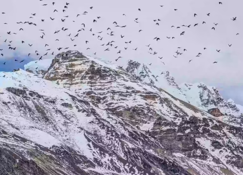

A morning flight takes you from Kathmandu to Biratnagar, one of the main gateway cities in eastern Nepal. After landing, the road journey begins toward the hills, leaving the plains behind and climbing gradually toward Taplejung.

The drive is long, but the landscape keeps changing throughout the day. You pass warm lowlands, tea-growing areas, terraced fields, rivers, and hill settlements before reaching Taplejung Bazaar, the main access town for the Kanchenjunga region.

  • Flight duration: 40 to 45 minutes

  • Drive duration: 8 to 9 hours

  • Drive distance: 230 to 250 km / 143 to 155 miles

  • Maximum altitude: 1,820m / 5,971ft

  • Elevation loss: +1,740m / +5,709ft

Note: Buy any last-minute trekking supplies in Taplejung because shops and services become limited after this point.

The day starts with a mountain road drive from Taplejung toward Rani Pul. The road drops through scattered villages, forested slopes, and river valleys before reaching the lower trail access point.

From Rani Pul, a short first walk takes you toward Sekathum. This gentle trekking section follows the river, crosses suspension bridges, and gives your legs an easy start before the longer climbing days ahead.

  • Drive duration: 3 to 4 hours

  • Drive distance: Approx. 70 km / 43.5 miles

  • Trek duration: 2 to 3 hours

  • Trek distance: Approx. 10 km / 6.2 miles

  • Maximum altitude: 1,820m / 5,971ft near Taplejung

  • Elevation loss: -220m / -722ft

Note: Walk slowly on the first trekking day and let your body adjust to the trail rhythm.

Your first long walking day starts with river crossings and a gradual climb into the northern Kanchenjunga route. The path follows the Ghunsa Khola through forest, cliffs, small waterfalls, and remote valley sections with fewer settlements.

As the trail rises toward Amjilosa, the landscape feels quieter and more enclosed by steep hillsides. Here, the teahouse stop is basic, but the peaceful setting gives you a clear taste of remote eastern Nepal.

  • Trek duration: 6 to 7 hours

  • Trek distance: Approx. 9 to 10 km / 5.6 to 6.2 miles

  • Maximum altitude: 2,510m / 8,235ft

  • Elevation gain/ loss: +910m / +2,986ft

Note: This is your first walking day, so avoid rushing even if the altitude still feels manageable.

After leaving Amjilosa, the route follows a gentler pace through thick forest with the Ghunsa Khola flowing below the trail. You pass shaded paths, waterfalls, wooden bridges, and hillside sections where the forest keeps the air cool.

The route rises and drops gently before reaching Gyabla, also known as Kyapra. This small mountain settlement sits above the river valley and gives you a calm overnight stop before the climb to Ghunsa.

  • Trek duration: 4 to 5 hours

  • Trek distance: 6 to 9 km / 3.7 to 5.6 miles

  • Maximum altitude: 2,730m / 8,956ft

  • Elevation gain/ loss: Approx. +220m / +722ft

Note: Forest paths stay damp after rain, so step carefully on mossy stones and wooden sections.

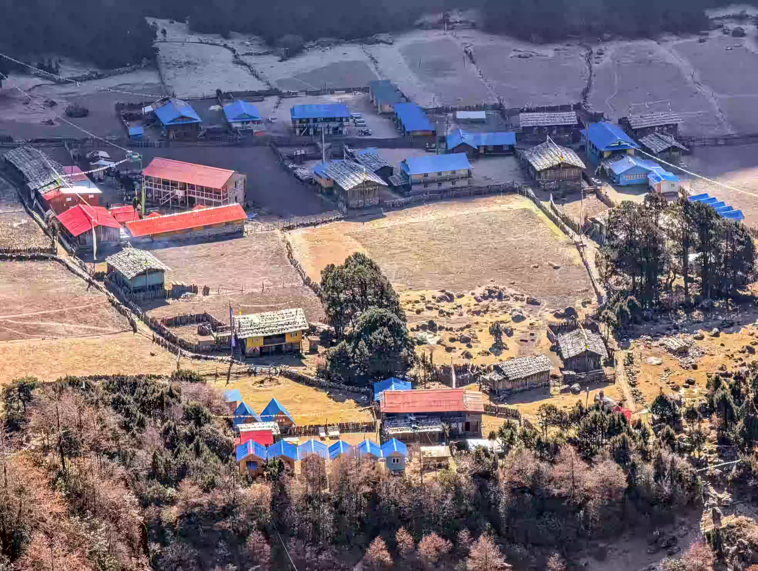
The trail leaves Gyabla and moves deeper into the upper Ghunsa Khola Valley. You walk through quiet forests, open valley sections, and small settlements before reaching Phole. It is a Tibetan-influenced village known for prayer flags, wooden houses, and mountain culture.

After Phole, the path climbs gradually toward Ghunsa, one of the main villages on the northern Kanchenjunga route. Ghunsa sits below forested slopes and snowy ridges, giving you a stronger high-Himalayan feel before the trek continues

  • Trek duration: 5 to 6 hours

  • Trek distance: 11 km / 6.8 miles

  • Maximum altitude: 3,595m / 11,795ft

  • Elevation gain: +745m / +2,444ft

Note: Your sleeping altitude rises sharply, so walk slowly, drink enough water, and report any altitude symptoms to your guide.

Ghunsa gives your body the pause it needs before the trail climbs above 4,000 meters. You spend the day walking slowly around the village, visiting the monastery, and hiking toward nearby viewpoints above the valley.

The short hike above Ghunsa helps you adjust to thinner air without moving to a higher sleeping place. From the upper slopes, you see forested ridges, prayer flags, yak-grazing areas, and the remote shape of the northern Kanchenjunga valley.

  • Hike duration: 4 to 5 hours

  • Hike distance: Approx. 5 to 7 km / 3.1 to 4.3 miles

  • Maximum altitude: Approx. 3,990m / 13,091ft

  • Elevation gain/loss: +395m / +1,296ft, then -395m / -1,296ft

Note: Keep the hike slow, drink water often, and return to Ghunsa if you feel a headache, nausea, dizziness, or unusual tiredness.

The trail climbs out of Ghunsa and enters a wilder part of the Kanchenjunga North Base Camp route. You follow the Ghunsa Khola through larch, juniper, and rhododendron forest before the valley opens into rough alpine ground.

As you move closer to Kambachen, the scenery becomes colder, wider, and more dramatic. The route passes rocky sections, glacial streams, and landslide-prone slopes with strong views toward Jannu, also known as Kumbhakarna.

  • Trek duration: 5 to 6 hours

  • Trek distance: Approx. 10 km / 6.2 miles

  • Maximum altitude: 4,145m / 13,599ft

  • Elevation gain: +455m / +1,493ft

Note: Follow your guide closely through landslide sections and avoid stopping directly underneath loose rock slopes.

Kambachen is the second key acclimatization stop before reaching Lhonak and Pangpema. You stay at the same sleeping altitude and take a steady hike above the village. The route gives clearer views of Jannu, rocky ridges, yak pastures, and the upper Kanchenjunga valley.

After the hike, you return to Kambachen for lunch, rest, and hydration. This active rest day helps your body prepare for the colder and thinner air ahead.

  • Hike duration: 4 to 5 hours

  • Hike distance: Approx. 8 km / 5 miles round trip

  • Maximum altitude: 4,515m / 14,813ft

  • Elevation gain/loss: +370m / +1,214ft, then -370m / -1,214ft

Note: Tell your guide if you feel a headache, nausea, dizziness, poor sleep, or unusual tiredness.

Kambachen slowly disappears behind you as the trail enters dry alpine terrain and glacier-side landscapes. The path climbs past Ramtang, moraine sections, frozen stream areas, and open slopes shaped by glacier movement.

By the time you reach Lhonak, the valley feels wide, silent, and far from the lower villages. Lodges are simple here, but their location gives you a strong sense of isolation and mountain scale.

  • Trek duration: 5 to 6 hours

  • Trek distance: Approx. 9 km / 5.6 miles

  • Maximum altitude: Tserko Ri, 5,033m / 16,512ft or Kyanjin Ri, 4,773m / 15,659ft

  • Elevation gain:+730m / +2,395ft

Note: Nights are cold at Lhonak, so keep your down jacket, gloves, warm hat, and sleeping layers ready.

This is the main highlight of the trek. You start early from Lhonak and follow the glacier-side trail toward Pangpema, also known as Kanchenjunga North Base Camp. The walk is not technical, but the altitude, cold wind, and rough moraine terrain make the day demanding.

At Pangpema, you stand below the huge north face of Kanchenjunga. The views are wide, raw, and unforgettable, with glaciers, rocky ridges, and snowy peaks surrounding the upper valley. After spending time at the viewpoint, you return to Lhonak for the night.

  • Trek duration: 7 to 8 hours

  • Trek distance: Approx. 14 to 16 km / 8.7 to 10 miles round trip

  • Maximum altitude: 5,143m / 16,873ft

  • Sleeping altitude: 4,780m / 15,682ft

  • Elevation gain/ loss: +363m / +1,191ft, then -363m / -1,191ft

Note: Start early, carry enough water and snacks, wear warm layers, and avoid staying too long at the highest point.

Your return journey begins with a long descent from the upper valley. You retrace the route through moraine paths, glacial streams, and open alpine ground toward Kambachen. The thinner air becomes easier as you lose altitude, but the distance still demands focus.

After Kambachen, the trail continues toward Ghunsa through rocky slopes and forested sections. Ghunsa feels warmer, more settled, and more comfortable after the remote nights near Lhonak.

  • Trek duration: 7 to 8 hours

  • Trek distance: Approx. 19 to 21 km / 11.8 to 13 miles

  • Maximum altitude: 4,780m / 15,682ft

  • Sleeping altitude: 3,595m / 11,795ft

  • Elevation loss: -1,190m / -3,904ft

Note: Use trekking poles because the long descent strains knees and ankles.

The trail leaves Ghunsa and returns through Phale, Gyabla, and the upper Ghunsa Khola valley. You pass prayer flags, wooden houses, forest paths, and riverside sections that feel more familiar now.

You continue past Gyabla and descend through oak, rhododendron, bamboo, and shaded forest paths. Amjilosa appears after several hours of steady downhill walking through the Ghunsa Khola valley.

  • Trek duration: 6 to 7 hours

  • Trek distance: Approx. 12 to 14 km / 7.5 to 8.7 miles

  • Maximum altitude: 3,595m / 11,795ft

  • Sleeping altitude: 2,510m / 8,235ft

  • Elevation loss: -1,085m / -3,560ft

Note: Walk carefully on wet forest steps because the lower trail stays slippery, especially after rain.

The final trekking day follows the lower Ghunsa Khola valley back toward Sekathum. You descend through forest paths, stone steps, river bends, and small village sections. The trail feels warmer and greener after the cold alpine landscapes near Lhonak and Pangpema.

Several suspension bridges and riverside paths keep the walk scenic until the last section. Sekathum marks the end of your walking route on the Kanchenjunga North Base Camp Trek. After reaching the lodge, you rest and prepare for the long road journey toward Fikkal.

  • Trek duration: 4 to 5 hours

  • Trek distance: Approx. 9 km / 5.6 miles

  • Maximum altitude: Amjilosa, 2,510m / 8,235ft

  • Sleeping altitude: Sekathum, 1,600m / 5,249ft

  • Elevation gain/ loss: -910m / -2,986ft

Note: Walk carefully on downhill stone steps because tired legs increase the chance of slipping.

After breakfast at your lodge in Sekathum, you board your private vehicle and begin the long road journey out of the Kanchenjunga region. The drive follows rough mountain roads through river valleys, terraced fields, and hillside villages. 

This section brings you back toward Taplejung, the main access town for the trek. From here, the road continues toward the green tea hills of Fikkal. The scenery changes from remote mountain valleys to softer hills, roadside towns, and tea-growing landscapes.

  • Drive duration: 10 to 12 hours

  • Drive distance: Approx. 260 km / 161 miles

  • Maximum altitude: Taplejung, approx. 1,820m / 5,971ft

  • Sleeping altitude: Fikkal, approx. 1,500m / 4,921ft

Note: Keep water, snacks, medicine, warm layers, and valuables in your day bag.

The drive from Fikkal to Bhadrapur takes you down from the tea hills toward the warmer plains. You pass tea estates, roadside towns, and lower farmland before reaching the airport city, Bhadapur.

Bhadrapur is your final overnight stop before flying back to Kathmandu. You have time to rest, organize your bags, and enjoy a slower evening after the long trek.

  • Drive duration: 3 to 4 hours

  • Drive distance: 65 to 75 km / 40 to 47 miles

  • Maximum altitude: 1,500m / 4,921ft

  • Elevation loss: 1,350m / 4,429ft

Note: Keep your flight documents ready and confirm the next day’s flight schedule with your guide.

The flight from Bhadrapur brings you back from the eastern plains to the Kathmandu Valley. On a clear day, the short flight gives a final look at Nepal’s hills before landing in the capital.

After arrival, our team transfers you to your hotel. The rest of the day is free for rest, laundry, souvenir shopping, or a relaxing spa visit. In the evening, we provide a farewell dinner and celebrate the completion of your trek to Kanchenjunga North Base Camp.

  • Flight duration: 40 to 45 minutes

  • Drive duration: 25 to 30 minutes private transfer in Kathmandu

  • Maximum altitude: 1,395m / 4,577ft

  • Elevation loss: 1,350m / 4,429ft

Note: Domestic flights depend on weather and airport schedules, so keep this day flexible.

Your Kanchenjunga North Base Camp Trek ends with a private transfer to Tribhuvan International Airport. Our team picks you up from your hotel according to your international flight schedule.

If your flight leaves later in the day, you have time for a slow breakfast or a short walk near your hotel. You leave Nepal with memories of Pangpema, Jannu, Ghunsa Valley, tea hills, and the quiet northern side of Kanchenjunga.

  • Drive duration: 25 to 30 minutes private airport transfer

  • Drive distance: 5 to 7 km / 3.1 to 4.3 miles, depending on hotel location

  • Maximum altitude: 1,395m / 4,577ft

  • Elevation loss: 1,350m / 4,429ft

Note: Reach the airport at least 3 hours before your international flight.

Cost Includes

Cost Excludes

Trekking Feasibility
Calculating...
Projections represent historical trends and general seasonal elevation conditions.
Route Stop & Elevation
Daytime (Sunny)
Nighttime (Cold)

Note: These temperatures represent general spring and autumn conditions. High-altitude weather can change quickly.

The best time for the Kanchenjunga North Base Camp Trek is spring and autumn. Spring runs from March to May and brings warmer days, blooming rhododendron forests, and better walking conditions in the lower valleys. As the trail climbs toward Ghunsa, Kambachen, Lhonak, and Pangpema, the air becomes colder, so warm layers still remain essential.

Autumn runs from September to November and offers clear skies, stable weather, and strong mountain views. This season gives you better visibility around Jannu, Kanchenjunga, and the glacier valley near Pangpema. Whereas winter brings harsh cold in the upper valley, and the monsoon brings rain, slippery trails, leeches, cloud cover, and rougher road access, which make the trail difficult.

Accommodation on the Kanchenjunga North Base Camp Trek is simple, warm, and practical. You stay in hotels in Kathmandu, Taplejung, Fikkal, and Bhadrapur, while trekking nights are in local teahouses. Rooms usually have basic beds, blankets, shared toilets, and a dining room where trekkers gather at night.

Meals are simple but filling. You get dal bhat, noodles, fried rice, soup, potatoes, eggs, Tibetan bread, pancakes, tea and coffee in most teahouses. Around Taplejung and lower Limbu areas, you find local tea, gundruk, kinema, chhurpi, and sukuti. 

Food choices become more limited after Ghunsa, especially in Kambachen and Lhonak. So, carry a few snacks such as nuts, energy bars, chocolate, and electrolyte powder for long walking days.

The Kanchenjunga North Base Camp Trek is a challenging trek. You do not need climbing skills, but you need strong fitness, previous hiking experience, and the ability to walk for several hours on remote mountain trails.

The main challenges are long access roads, basic facilities, altitude, cold weather, rough paths, and limited services in the upper valley. The route reaches Pangpema at approx. 5,143m / 16,873ft, so acclimatization days in Ghunsa and Kambachen are important.

This trek is best for trekkers who want solitude and remote Himalayan scenery more than comfort. Steady pacing, hydration, warm clothing, and guide support make the journey safer and more enjoyable.

Kanchenjunga North Base Camp Trek moves from warm lowland areas to cold high-altitude valleys near glaciers. So, pack light, but carry enough warm layers, rain protection, and reliable trekking gear.

Plan Your Kanchenjunga Trek with Us

Ready to walk into one of Nepal’s quietest Himalayan regions? Get in touch with Joyful Eco Treks to plan your 18-day journey with licensed guide support, proper permits, safe acclimatization, private transport, meals, accommodation, and clear cost details.

Frequently Asked Question

How much does the Kanchenjunga North Base Camp Trek cost?

The cost depends on group size, hotel category, domestic flights, private transport, guide and porter service, permits, meals, and included services. A private trek usually costs more than a group trek because the logistics are shared by fewer people. For an accurate price, share your travel date, group size, and service preference with Joyful Eco Treks.

Yes, you need permits for this trek because the route enters both a restricted area and the Kanchenjunga Conservation Area. The main permits are the Kanchenjunga Restricted Area Permit and the Kanchenjunga Conservation Area Permit. A registered trekking agency arranges these permits with your passport and visa details.

No, independent trekking without a guide is not allowed in the Kanchenjunga restricted area. Foreign trekkers must arrange the trek through a registered trekking agency and travel with a licensed Nepali guide. This rule helps with permit control, route safety, and emergency support in remote areas.

The highest point is Pangpema, also known as Kanchenjunga North Base Camp, at approx 5,143m / 16,873ft. This viewpoint gives close views of the north face of Mount Kanchenjunga and the surrounding glacier landscape. Proper acclimatization is important before reaching this altitude.

The trek is challenging because of its length, altitude, remote location, basic facilities, and long travel days. You should be comfortable walking 5 to 7 hours on most trekking days, with one longer day to Pangpema and back. Previous trekking experience is strongly recommended.

You usually need 18 to 22 days for a comfortable Kanchenjunga North Base Camp itinerary from arrival to departure. This pace gives you enough time to reach Pangpema safely, return through the same northern valley, and avoid rushing the high-altitude sections.

Kanchenjunga North Base Camp is better if you want a quieter, wilder, and more remote trek with fewer people. Everest Base Camp is better if you want easier access, more developed lodges, and a more famous classic route. Choose Kanchenjunga if solitude and raw Himalayan scenery matter more than comfort.

The best time is March to May and September to November. Spring has warmer days and blooming forests in the lower region, while autumn offers clearer skies and stable mountain views. Winter is very cold in the upper valley, and the monsoon can make roads and trails harder.

You can see Kanchenjunga, Jannu (Kumbhakarna), and several surrounding peaks from different parts of the route. The strongest mountain views come near Kambachen, Lhonak, and Pangpema. Clear weather gives the best views in spring and autumn.

Taplejung is famous for Mount Kanchenjunga, Pathibhara Devi Temple, Limbu culture, remote Himalayan villages, and the Kanchenjunga Conservation Area. It also works as the main gateway district for the Kanchenjunga trekking region.

Sekathum is a lower trail stop on the northern approach to Kanchenjunga. Trekkers usually reach Sekathum after driving from Taplejung toward Ranipul, then continue walking toward Amjilosa.

Ghunsa is known as the main village on the northern Kanchenjunga route. It has better teahouse facilities, a monastery, local offices, and an important acclimatization stop before Kambachen and Lhonak.

Ready to Trek to Kanchenjunga North Base Camp?

Share your travel dates, group size, fitness level, and trekking experience, and our local team will help you plan the best 18-day Kanchenjunga North Base Camp Trek with proper permits, licensed guide support, safe pacing, private transport, meals, accommodation, and clear cost details.