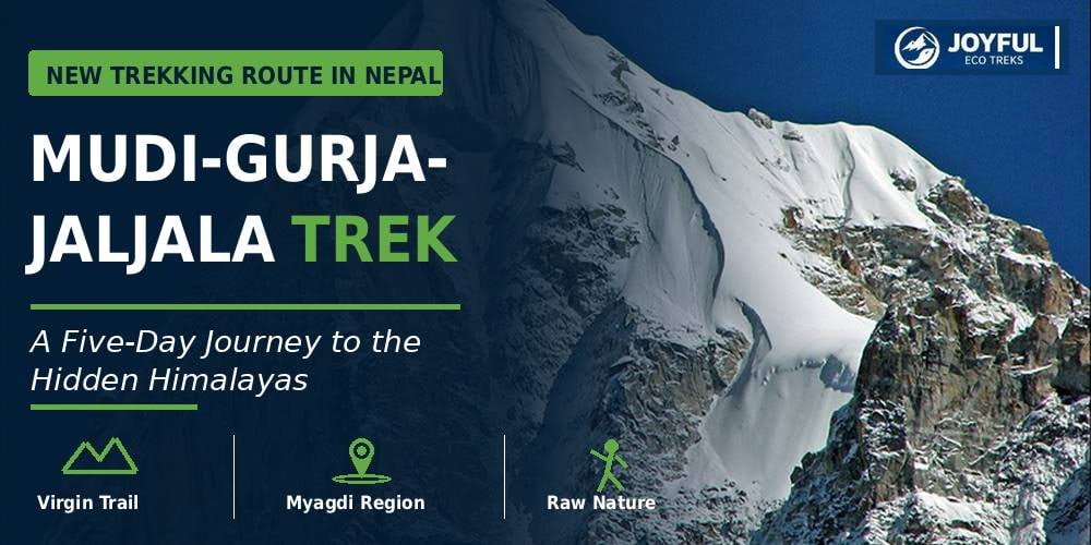
Mudi–Gurja–Jaljala Trek: A New Five-Day Trekking Route in Myagdi
A new five-day trekking route linking Mudi, Gurja, Rughachaur, and Jaljala is being prepared in the Dhaulagiri/Dhawalagiri Rural Municipality of Myagdi. The trail is planned to pass through remote villages, forested hills, quiet ridges, and open mountain areas away from Nepal’s busier trekking corridors.
The route gained wider attention after Mahabir Pun, an independent Member of Parliament from Myagdi and the Minister for Science, Technology and Innovation, announced that preparations were underway. The initiative, which recently completed a feasibility study, is receiving infrastructure support from the Department of Tourism.
The trek is still under development, so facilities such as route signs, bridges, rest stops, accommodation, communication, and rescue support are not yet fully in place. The route details below follow the available announcement and plan, while daily walking times, elevations, overnight stops, and exact trail conditions still need local verification.
- The Mudi–Gurja–Jaljala Trek is a proposed five-day route through remote parts of Myagdi, passing Mudi, Gurja, Rughachaur, and Jaljala.
- The trail combines traditional villages, terraced farmland, rhododendron forests, high ridges, and open alpine meadows below the Dhaulagiri range.
- Gurja Village is a main cultural stop, where trekkers can experience Chhantyal community life, local meals, and simple homestay accommodation.
- Beyond Gurja, the route becomes more remote, with limited settlements, weak mobile coverage, and possible camping in the upper sections.
- The trail is still under development, so trekkers should confirm current conditions, travel with a local guide, and prepare for limited facilities and emergency support.
Table of Contents
ToggleWhat Is the Mudi–Gurja–Jaljala Trek?
The Mudi–Gurja–Jaljala Trek is a proposed five-day trekking route through the remote mountain landscapes of Myagdi. The journey begins in Mudi, passes through Gurja, and continues toward Rughachaur and Jaljala, with the potential of extending to Dhorpatan and Maikot in the future.
Also known as the Mudi–Gurja–Rughachaur–Jaljala Trek, it is classified as a “virgin trail” because it does not yet operate as a regular commercial trekking route. Infrastructure such as fixed teahouse lodges, marked trail signs, and established daily walking stages is currently under development.
The trek offers a peaceful wilderness experience through high-altitude farmland, rhododendron forests, quiet mountain ridges, and traditional settlements. Along the way, trekkers can experience the distinct cultures of the Magar, Dalit, and minority Chhantyal communities while exploring one of the least-visited corners of the Dhaulagiri region.
Where Is the Mudi–Gurja–Jaljala Trek Located?
The Mudi–Gurja–Jaljala Trek lies in the Myagdi district of Gandaki Province in western Nepal. Most of the route falls within the Dhaulagiri Rural Municipality, beginning from Mudi in Ward No. 4, passing through Gurja in Ward No. 1, and continuing toward Jaljala in Ward No. 2.
Mudi sits near the foot of the massive Dhaulagiri Himal, the world’s seventh-highest mountain. The surrounding terrain features steep slopes, deep river valleys, dense forests, and high-altitude mountain settlements.
Gurja lies deeper inside the mountain region and is often called the “hidden village” because of its isolated, bowl-shaped valley. From Gurja, the trail ascends toward Rughachaur and the alpine meadows of Jaljala, a rugged landscape with very few human settlements and no motorable roads.
Rughachaur lies along the high ridges heading toward Dhorpatan, while Jaljala sits directly on the border of the pristine Dhorpatan Hunting Reserve. These upper wilderness sections offer wide, panoramic views of the Dhaulagiri range and a profound sense of remoteness.
Also Read:
Best Treks in Nepal: Find the Right Trail for Your Next Adventure
Trekking Rules in Nepal: Updated Guide for 2026
Proposed Mudi–Gurja–Jaljala Trek Route
The trekking route begins in Mudi Village and follows an ancient herding corridor. The trail passes through a defined sequence of settlements and high-altitude junctions before concluding at the alpine meadows of Jaljala.
1. Mudi Village (The Starting Point)
Mudi serves as the primary gateway and logistics hub for the trek. Inhabited predominantly by the Magar and Dalit communities, this village is the final point for trekkers to secure local guides, stock up on food supplies, and gather current trail updates before heading into the wild terrain.
2. Nerbang, Arche, and Demo (Stage 1)
From Mudi, the trail cuts through the traditional settlements of Nerbang and Arche before climbing toward Demo. This opening leg transitions through low-altitude terraced farmlands, local village paths, and forested hillsides. Demo serves as the designated end of the first day’s walk, where you stay in community-arranged local housing.
3. Haple, Kharibas, Ghurma, and Luchhrabang (Stage 2)
Leaving Demo, the trail advances deeper into rural terrain, passing through the small farming settlements of Haple, Kharibas, and Ghurma. This section is strictly characterized by basic rural conditions. There are no commercial menus or standard tourist lodges here; the route relies entirely on simple, authentic community hospitality.
4. Gurja Village (The Cultural Hub)
Gurja is the geographic and cultural centerpiece of the itinerary. Known locally as the “hidden village” due to its isolated, bowl-shaped valley, it is home to the minority Chhantyal community. The village operates on a community-based tourism model, providing trekkers with organized homestays, traditional local meals, and cultural immersion.
5. Bhisne, Ratmate, Dhunga Ghar, and Jogimare (Stage 3)
Past Gurja, the route enters a high-wilderness zone. The trail progresses past the Bhisne junction and ascends through Ratmate, Dhunga Ghar, and Jogimare. Because this upper stretch has no permanent human settlements and lacks reliable mobile network coverage, trekkers must travel self-sufficiently with emergency equipment and adequate rations.
6. Rughachaur (The Viewpoint)
Rughachaur sits on the high ridge system connecting Gurja to the upper wilderness. This point acts as a natural horizon bridge, offering sweeping, unobstructed views of the Dhaulagiri massif and neighboring Himalayan peaks.
7. Tallo Jaljala and Upallo Jaljala (The Final Destination)
The trek reaches its climax at the twin alpine plateaus of Tallo (Lower) Jaljala and Upallo (Upper) Jaljala. Averaging between 2,000 to 3,300 meters (around 6,500 to 10,800 feet) in altitude, these open grasslands form the official end of the 5-day corridor. The area features dramatic mountain architecture and holds deep spiritual significance for local communities.
8. Future Extensions: Dhorpatan and Maikot
For trekkers seeking a longer expedition, the trail design allows for a direct connection from Jaljala into the Dhorpatan Hunting Reserve and onward to Maikot. This connecting web establishes a grand cross-district corridor linking Myagdi, Baglung, and East Rukum.
Five-Day Mudi–Gurja–Jaljala Trek Itinerary
The route covers roughly 45 to 50 kilometres (28 to 31 miles), starting from Mudi Village, passing through the hidden village of Gurja, and ending at the alpine meadows of Jaljala (up to 3,300 meters / 10,800 feet).
Day 1: Mudi Village to Demo Area
The trek begins at the gateway hub of Mudi, following the primary village trail downward toward Nerbang. From there, the path climbs steadily through Arche before entering the Demo area.
Trekkers spend the first night in community-arranged housing around Demo, surrounded by low-altitude farmland and dense forest edges.
Day 2: Demo Area to Gurja Village
The second day features a steady ascent through the rural farming settlements of Haple, Kharibas, Ghurma, and Luchhrabang. The day ends at Gurja, the primary cultural center of the trail.
This stage brings you directly into the heart of the Chhantyal community, with overnight accommodation hosted in organized local homestays.
Day 3: Gurja Village to Bhisne or Ratmate
Leaving Gurja, the trail enters a completely uninhabited wilderness zone. The route passes the high-altitude junction at Bhisne before advancing toward the ridges of Ratmate.
Because this section lacks permanent settlements, the final overnight stop relies on a self-contained wilderness campsite chosen based on daily water availability.
Day 4: Ratmate to Jaljala
From Ratmate, the trail passes through the isolated rocky outcrops of Dhunga Ghar and Jogimare before emerging onto the alpine meadows of Tallo Jaljala and Upallo Jaljala.
This is the most physically demanding stage of the trek due to the significant elevation gain and remote terrain. Trekkers must travel fully prepared with sufficient water, food rations, and cold-weather gear.
Day 5: Jaljala and Route Exit
The final day begins with sunrise views across the vast, open grasslands of the Jaljala plateau, offering panoramic vistas of the Dhaulagiri range. From the highlands, trekkers descend along the designated exit trail back toward the Myagdi roadhead.
You can choose to extend the trip into Dhorpatan or Maikot if they are fully prepared to camp.
What Makes This Trek Different?
The Mudi–Gurja–Jaljala Trek stands out because it combines untouched wilderness, deep cultural immersion, and panoramic mountain views. It offers a rare, raw alternative to Nepal’s heavily commercialized trekking hubs.
- A Pure Wilderness Trail: Because this route operates outside Nepal’s regular commercial trekking network, it completely avoids the crowds, shops, and large tourist groups found on classic trails. It offers a quiet, pristine environment for trekkers seeking a genuine wilderness experience.
- Remote Village Experience: The trail cuts directly through working villages like Mudi and Gurja, where farming, livestock, and traditional customs shape daily life. Instead of staying in commercialized tourist hubs, visitors connect directly with local Magar, Dalit, and minority Chhantyal communities through authentic homestays.
- Dhaulagiri Mountain Setting: The entire trail walks below the massive Dhaulagiri mountain range. The high ridges of Rughachaur and the open fields of Jaljala give you perfect spots to view the world’s seventh-highest peak up close.
- Forests, Valleys, and Open Ridges: The trail provides exceptional geographical variety. Rather than following a single river valley or dirt road, the path transitions constantly through terraced farmlands, dense rhododendron forests, narrow mountain ridges, and wide alpine plateaus.
- Future Connection with Dhorpatan and Maikot: The strategic design of this trail makes it a valuable geographic link. Once the path is fully established, it will serve as the primary gateway connecting Myagdi, Baglung, and East Rukum, opening up a grand cross-district trekking corridor.
- Strong Local Participation: Backed by Mahabir Pun, this trail relies entirely on local people. The residents handle everything from trail clearing and guiding to hosting you in their homes. This ensures that the money you spend goes directly to funding local education and even healthcare.
What Scenery Can Trekkers Expect?
Trekkers enjoy a massive mix of mountain views, deep valleys, forest trails, and remote farming settlements.
The Changing Landscapes
- The Lower Trail: The first few days take you through green terraced farmland, traditional village paths, and lush forest edges.
- The Upper Highlands: Beyond Gurja, the trail enters a quiet wilderness. The forest opens up into narrow mountain ridges and the massive alpine grasslands of Rughachaur and Jaljala.
- The Mountain Backdrop: The massive Dhaulagiri range forms the main backdrop of your journey. You also get clear views of Gurja Himal and nearby peaks from different angles along the ridges.
Weather and Seasons
- Autumn (September to November): Brings the crispest air and the clearest mountain views.
- Spring (March to May): Offers green forests and bright, blooming rhododendron flowers.
- Winter (December to February): Covers the high ridges and the Jaljala plateau in thick snow.
- Monsoon (June to August): Creates incredibly lush, green landscapes, but makes the trails wet and challenging.
You may also read: Best Treks in Nepal
When Is The Best Time for the Mudi–Gurja–Jaljala Trek?
The best time to trek the Mudi–Gurja–Jaljala route is during the autumn season, from October to November, followed closely by the spring season, from March to May. These months offer the safest trail conditions and the most stable weather for this new route.
The Best Windows for Trekking
- Autumn (September to November): This is the safest and most reliable window for the trek. The paths are dry, and trail navigation is at its easiest. Just be sure to verify local bridge crossings right after the monsoon ends.
- Spring (March to May): A fantastic secondary option. The weather is comfortably mild for walking, though you should verify water availability at the higher wilderness campsites before setting out.
High-Risk Windows
- Winter (December to February): This is a highly challenging window. The upper sections around Rughachaur and Jaljala face extreme sub-zero cold and blocked passes. Only attempt this if local teams explicitly confirm the trail is passable and you have heavy cold-weather gear.
- Monsoon (June to August): Avoid this season. Heavy rains cause active landslides, muddy trails, and dangerous, swollen stream crossings. Mudslides also frequently block the main access roads to Mudi.
You may also read: Best Time to Visit Nepal
How Difficult Is the Mudi–Gurja–Jaljala Trek?
Because this route is still developing, it requires a higher level of fitness and preparation than established commercial trails.
- Demanding Terrain: You face long walking days with steep, continuous climbs and sharp descents over rough forest paths and rocky ridges.
- Remote Isolation: Once you pass Gurja Village, you enter a true wilderness zone. There are limited settlements, electricity, and mobile network coverage.
- Limited Logistics: Food, emergency rescue access, and regular accommodations are also limited in the upper sections. You must camp and travel fully self-sufficiently with a local crew.
What to Pack for the Trek
Pack sturdy waterproof boots, warm layered clothing, a full four-season camping kit, a headlamp, power banks, a water filter, enough physical cash (NPR )to cover all village expenses, and know some basic trekking rules.
Clothing & Footwear
- Sturdy Trekking Boots: Waterproof with good ankle support.
- Layered Clothing: Thermal base layers, a warm down jacket, and a waterproof outer shell.
Camping & Electronics
- Wilderness Kit: A four-season tent, a cold-weather sleeping bag (down to -10°C), and a camp stove.
- Power & Light: A bright headlamp and at least two high-capacity power banks.
Health & Cash
- Water & First Aid: A water filter or purification tablets, plus a basic medical kit with blister care.
- Cash (NPR): Enough physical local money for homestays, porters, and food. There are no ATMs.
What Are The Permits and Local Requirements?
Because this is a brand-new trail, a finalized, dedicated permit system is not yet in place. However, you must plan for two specific requirements:
- Local Registration: You will need to complete local visitor logging and pay municipal fees at checkpoints managed by the Dhawalagiri Rural Municipality upon arrival.
- Dhorpatan Hunting Reserve Permit: If you choose to extend your trek toward Dhorpatan, you must purchase an entry permit. This costs 3,000 NPR for foreigners, 1,500 NPR for SAARC nationals, and 100 NPR for Nepalis. You can buy this at the Nepal Tourism Board in Kathmandu or directly at the reserve gate.
Safety Tips for the Mudi–Gurja–Jaljala Trek
- Hire a Local Guide: This is non-negotiable for the early stages. You need local knowledge to navigate hidden trail junctions, find water sources, and safely cross steep sections.
- Check Conditions Daily: Always get real-time updates on weather, snow levels, and bridge conditions from village locals before moving to the next camp.
- Prepare for No Signal: Mobile coverage can disappear completely after you leave the main villages. Carry offline maps and tell your hosts your exact daily plan.
- Pack Emergency Backups: Never travel light on the upper ridges. Always carry an emergency shelter, extra rations, a full medical kit, and warm gear to handle sudden mountain storms.
Conclusion
The Mudi–Gurja–Jaljala Trek brings a fresh, community-driven trekking experience to a quiet corner of Myagdi. By walking this trail, you get a genuinely peaceful alternative to Nepal’s busier, road-heavy routes while directly supporting local families.
Because the trail is still under development, planning the journey requires specialized expertize and deep local connections. If you are ready to be one of the first to explore this untouched wilderness, contact Joyful Eco Treks. From organizing self-sufficient camping gear to pairing you with experienced local guides, we are ready to handle all the groundwork for you.
See more travel stories, destination updates, trekking photos, and trip ideas from Nepal. Follow Joyful Eco Treks on Facebook, Instagram, and TikTok and stay connected with our latest adventures.
FAQs
How many days is the Mudi–Gurja–Jaljala Trek?
The Mudi–Gurja–Jaljala Trek is planned as a five-day trekking route.
Where does the trek begin?
The trek begins from Mudi Village in Dhawalagiri Rural Municipality, Myagdi.
Does the route pass through Gurja Village?
Yes, the route passes through Gurja Village, which is the main settlement before continuing toward Rughachaur and Jaljala.
Is the trek open now?
The route has been announced, but preparation work is still underway, and it is not yet fully operational.
Can the trek continue to Dhorpatan?
A future connection to Dhorpatan is planned, but it has not yet been developed as a regular trekking extension.
Can trekkers continue toward Maikot?
Maikot is included as a possible future extension from Jaljala, but this section still requires further development and verification.
Is accommodation available?
Basic local accommodation may be available in Mudi and Gurja, while camping may be necessary in the more remote sections of the route.
Is a guide required?
A local guide is not officially required, but it is strongly recommended while the route is still under development.
Is the trek suitable for beginners?
The trek is currently better suited to experienced trekkers travelling with a local guide.
Are permits required for the Mudi–Gurja–Jaljala trek?
Final permit requirements have not yet been confirmed. Additional permits may be required if the route is extended toward Dhorpatan.
How do you reach Mudi Village?
Travel first to Beni in Myagdi, then continue by road toward Mudi in Dhawalagiri Rural Municipality.

All Categories