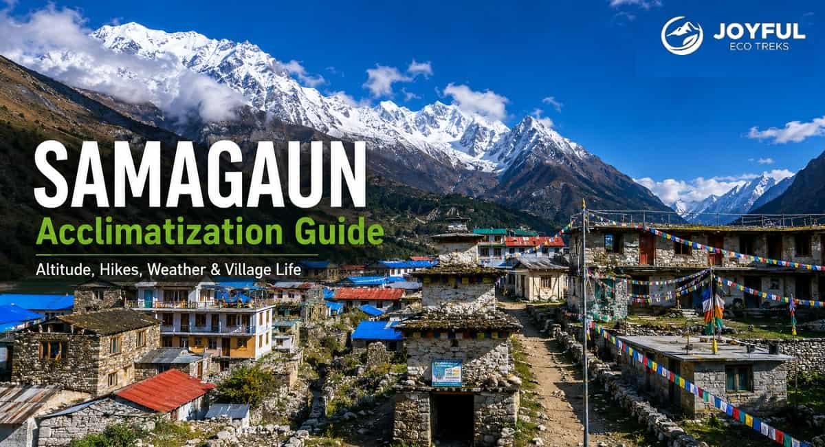
The Manaslu Circuit trek is a popular trekking trail in Nepal. Like other major routes, this trail has specific places where you must stop to acclimatize. Among them, Samagaun is one primary resting stop.
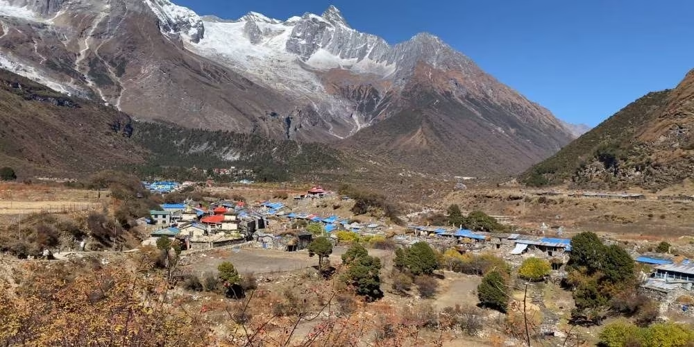
The beautiful village sits at an elevation of 3,530 meters (11,581 feet) above sea level. Hikers usually stay here for a day or two to prepare for the high pass ahead. Moreover, you have three beautiful destinations if you want to go for an active hike. Or, there are also plenty of relaxing things to do right inside the village.
This guide breaks down the hiking trails, village attractions, and local tips. So, you can easily pick the best option when acclimatizing at Samagaun.
- Samagaun sits at about 3,530 meters and serves as a major acclimatization stop on the Manaslu Circuit Trek.
- The acclimatization day helps your body adjust before moving toward higher areas and Larkya La Pass.
- Popular side hikes include Birendra Lake, Pungyen Gompa, and Manaslu Base Camp.
- Birendra Lake offers the easiest option, while Manaslu Base Camp gives the toughest full-day challenge.
- The village gives you close contact with Gurung and Bhote culture, traditional homes, monasteries, Mani walls, and local food.
- Teahouses, bakeries, homestays, electricity, and paid Wi-Fi are available, but there are no ATMs.
- Spring and autumn provide the best weather, clearer mountain views, and better trekking conditions.
Where Is Samagaun and What Is Its Altitude?
Samagaun, also spelled Samagaon or Sama Gaun, is a high-altitude village in Nepal’s Manaslu region in Gorkha. It sits at an elevation of about 3,530 meters (11,581 feet) on the Manaslu Circuit Trek. On the standard route, trekkers reach Samagaun after Shyala and continue toward Samdo, making the village an important acclimatization stop before Dharmasala and Larkya La Pass.
Here are some quick facts about Samagaun:
| Samagaun Quick Facts | Details |
| Altitude | 3,530 m / 11,581 ft |
| Region | Manaslu, Gorkha, Nepal |
| Main Trekking Routes | Manaslu Circuit Trek and Manaslu Tsum Valley Trek |
| Typical Stay | Usually two nights, including an acclimatization day |
| Next Major Stop | Samdo at about 3,860 m / 12,664 ft |
| Popular Side Hikes | Birendra Lake, Pungyen Gompa, and Manaslu Base Camp |
Why You Cannot Skip This Acclimatization Day
You cannot skip this acclimatization day because your body needs time to adjust to lower oxygen levels. During the Manaslu Circuit Trek or the Manaslu Tsum Valley Trek, Samagaun is a significant resting place. Rushing to higher altitudes without this break increases your risk of severe mountain sickness. It can even cause life-threatening conditions like fluid in your lungs (HAPE – High Altitude Pulmonary Edema) or swelling in your brain (HACE – High Altitude Cerebral Edema).
This extra time allows your body to adjust gradually to lower oxygen levels. During the first several days at altitude, your breathing rate increases and other physiological changes improve oxygenation and help your body tolerate the thinner air more effectively.
These days are not just for resting. They follow the critical mountain rule of “climb high, sleep low.” You can hike to a higher altitude during the day, then return to Samagaun to sleep at the same lower elevation, giving your body more time to adjust gradually.
Where To Hike During Your Samagaun Acclimatization (Main Attractions)
You can choose from three side-hikes around the village based on your energy levels. For a short and easy walk, visit the glacial waters of Birendra Lake. For a moderate cultural hike, head up to the historic Pungyen Gompa monastery. Similarly, for a tough physical challenge, climb all the way to Manaslu Base Camp.
Here is a quick comparison to help you choose the most suitable acclimatization hike:
| Hike | Maximum Altitude | Approx. Elevation Gain | Approx. Time | Difficulty | Best For |
| Birendra Lake | 3,691 m / 12,110 ft | 161 m / 529 ft | 2–3 hours | Easy | A shorter and gentler acclimatization hike |
| Pungyen Gompa | Around 4,050 m / 13,287 ft | About 520 m / 1,706 ft | 5–6 hours | Moderate | Culture, monastery visits, and mountain views |
| Manaslu Base Camp | 4,800 m / 15,748 ft | About 1,270 m / 4,166 ft | 7–9 hours | Challenging | Experienced and well-acclimatized trekkers |
1. Birendra Lake
Birendra Lake sits at an elevation of 3,691 meters (12,110 feet) above sea level. The trail spans a distance of 2.9 kilometers (1.8 miles) one way from the village. This alpine lake is famous because it formed entirely from melting Manaslu glaciers.
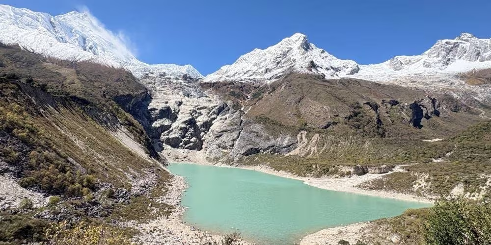
When you hike this path, you will have a steady walk through green yak pastures. The route climbs gradually without any difficult climbing sections. You will see the clear glacial waters reflect the surrounding snow peaks on clear days.
This short trip takes only two to three hours to complete round-trip. It gives your lungs a gentle introduction to the thin air before you move higher. It is a good choice for a relaxing acclimation day.
2. Pungyen Gompa
Pungyen Gompa rests at an elevation of around 4,050 meters (13,287 feet). The trail covers a distance of roughly 7.3 kilometers (4.5 miles) one way from your base. This ancient spot is famous for its deep spiritual history, and the local name means three peaks.
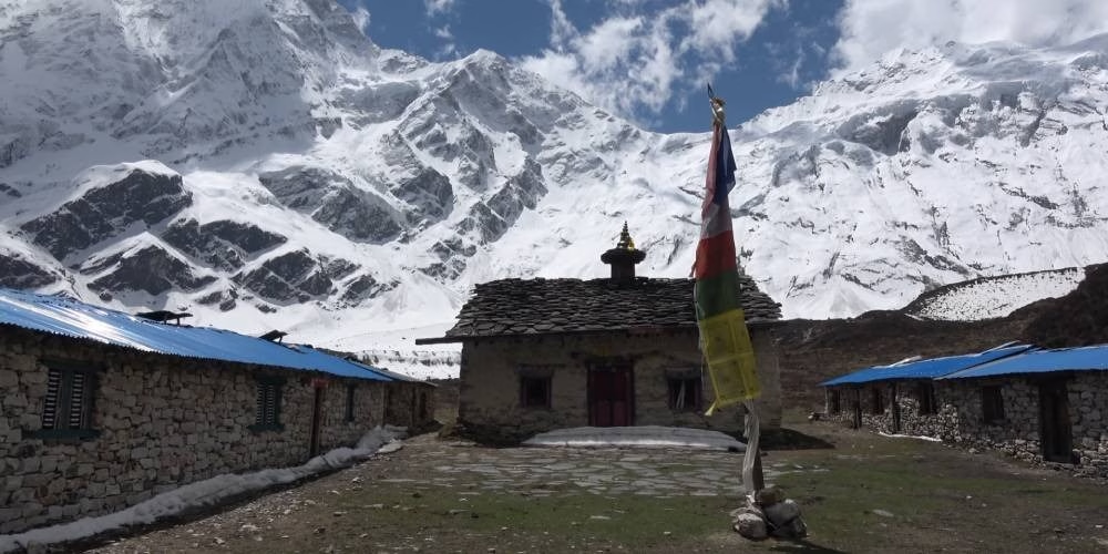
It is a moderately challenging trek along rocky trails and high alpine meadows. The monastery offers a serene environment where local monks perform daily Buddhist rituals. You will also view the glaciers of Mount Manaslu and the Ganesh Himal range.
This rewarding journey takes about five to six hours to complete in total. It provides a steady high-altitude hike while allowing you to return to Samagaun for sleep. You will enjoy historical discovery while preparing your lungs for the high pass.
3. Samagaun to Manaslu Base Camp: Distance, Altitude and Hiking Time
Manaslu Base Camp is at an elevation of 4,800 meters (15,748 feet). From Samagaun, the full hike is roughly 13.2 kilometers (about 8.2 miles) round-trip, with approximately 1,270 meters (4,166 feet) of elevation gain. It is famous as the starting point for climbers attempting to summit the mountain.
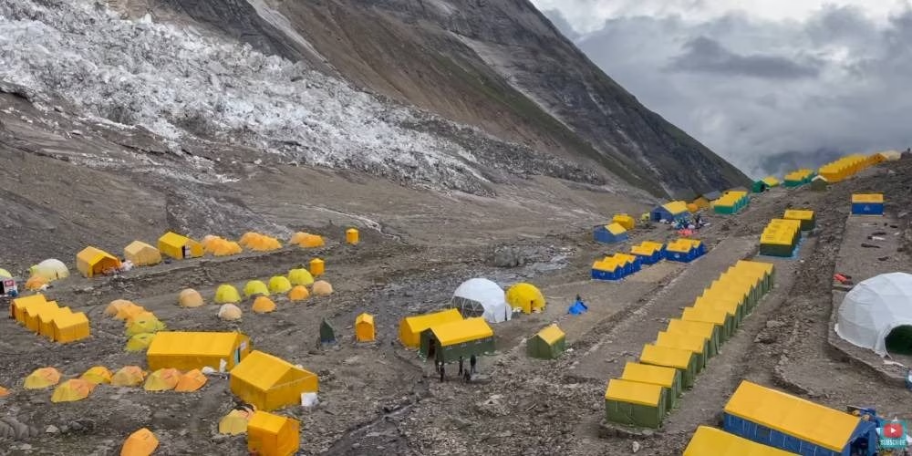
It is a steep climb over rough debris and rocky mountain ridges. The camp features a vibrant alpine environment filled with expedition tents during the climbing season. You will see close views of the glaciers and ice fields.
This demanding trek takes around seven to nine hours to complete from the village. Because the route climbs to 4,800 meters, it is best attempted only when you are feeling well, trail and weather conditions are suitable, and your guide considers the hike appropriate. If you have altitude-related symptoms or feel unusually tired, choose a gentler acclimatization option and avoid climbing higher.
Also Read: Manaslu Tsum Valley Trek: 20 Days Complete Itinerary and Guide
What Things Can You Do In The Samagaun Village?
First, you can explore ancient Mani walls, visit local bakeries, and watch yak caravans roll through the streets. Next, you can eat hot momos by a cozy fireplace, stay with a local family, and catch the sunrise at the Dharmsala viewpoint.
Apart from simply hiking to different trails, you will find plenty of rewarding activities to enjoy right inside the village.
- Cultural Gems: Walk past ancient stone Mani walls, spin colorful prayer wheels, and find peace inside historic stone chortens.
- Local Bakeries: Enjoy fresh pastries and warm drinks while you admire the steep north face of Mount Manaslu.
- Daily Routines: Watch heavy yak caravans move through the narrow streets and see locals working on traditional wood-carving arts.
- Local Food: Try simple, high-energy Himalayan dishes such as hot Dal Bhat, steamed momos, Tibetan bread with honey or jam, potato pancakes, traditional noodle soup (Thukpa), and yak butter tea at small local teahouses or by a cozy fireplace.
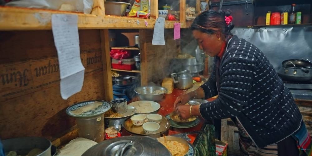
- Stay at Homestays: Sleep in humble wooden rooms with handmade rugs and see how local families preserve their traditional weaving skills.
- Gurung Traditions: Interact with the largest local ethnic group, who farm potatoes and barley on very steep mountain terraces.
- Bhote Culture: Learn from Tibetan-descent groups who live in flat-roofed stone houses and celebrate vibrant festivals like Lhosar.
- Dharmsala Ridge Viewpoint: Climb the saddle east of the village for two hours to catch amazing 360-degree views of the valley at sunrise.
How’s Samagaun’s Weather?
Since Samagaun is at a high altitude of 3,530 meters (11,581 feet), the weather changes in the blink of an eye. You might start your morning under clear skies and face freezing rain or snow by the afternoon. Therefore, you must prepare for sudden shifts every single day.
To handle this unpredictable mountain weather, pack smart and stay flexible. Always carry high-quality waterproof gear and warm layers in your daypack, even during the summer. Additionally, check the daily forecast with your guide before you leave the village for any side hikes.
What’s the Best Time to Visit Samagaun?
The absolute best times to visit Samagaun are the autumn and spring seasons. During these months, you will enjoy the most stable weather, comfortable walking temperatures, and exceptionally clear views of the peaks.
| Season | Months | Average Day Temp | Average Night Temp | Conditions & Trekking Viability |
| Spring | Mar – May | 10°C to 18°C (50°F to 64°F) | 0°C to -5°C (32°F to 23°F) | Excellent. Mild days, blooming flowers, and melting trail snow. |
| Monsoon | Jun – Aug | 11°C to 15°C (52°F to 59°F) | 5°C to 10°C (41°F to 50°F) | Poor. Heavy rain, hidden mountain views, and landslide risks. |
| Autumn | Sep – Nov | 8°C to 15°C (46°F to 59°F) | 0°C to -10°C (32°F to 14°F) | Peak Season. Crisp air, perfectly clear skies, and great photography weather. |
| Winter | Dec – Feb | Below 5°C (Below 41°F) | -8°C to -15°C (18°F to 5°F) | Harsh. Extreme cold, heavy snow, and blocked high mountain passes. |
Conclusion
Ultimately, Samagaun is much more than just a mandatory rest stop on your Himalayan journey. It is a vibrant cultural hub and a critical safety checkpoint that prepares your body for the high passes ahead. By taking the time to explore the village and tackle the nearby side-hikes, you turn a simple rest day into an unforgettable adventure.
However, planning a massive trek through the remote Manaslu region requires expert planning and reliable local guiding. Therefore, you can partner with Joyful Eco Treks to ensure a safe, sustainable, and deeply authentic journey. Contact us today to customize your itinerary and start your Himalayan dream adventure with complete peace of mind.
See more travel stories, destination updates, trekking photos, and trip ideas from Nepal. Follow Joyful Eco Treks on Facebook, Instagram, and TikTok, and stay connected with our latest adventures.
Frequently Asked Questions
What is Samagaun’s elevation?
Samagaun (also spelled Samagaon) sits at an elevation of roughly 3,530 meters (11,581 feet) above sea level, with some parts of the village stretching up to 3,800 meters.
How far is Samagaun from Kathmandu?
Samagaun (also spelled Samagaon) sits at an elevation of roughly 3,530 meters (11,581 feet) above sea level, with some parts of the village stretching up to 3,800 meters.
Samagaun is approximately 231 to 233 kilometers from Kathmandu by road and trail. Because there are no roads leading directly to the village, reaching it requires a 7 to 8-hour drive from Kathmandu to Machhakhola, followed by a multi-day trek.
What is the distance between Samagaun and Samdo?
The distance between Samagaun and Samdo on the Manaslu Circuit Trek is approximately 8 kilometers (about 5 miles). This hiking route takes about 3 to 4 hours to complete.
Is there Wi-Fi and electricity available in the village?
Yes, you will find both electricity and Wi-Fi in Samagaun. Most teahouses charge your devices for a small fee, and some offer internet for an extra cost. Therefore, you should carry a backup power bank and expect frequent connection dropouts.
Are there any ATMs in Samagaun, Gorkha?
No, there are no ATMs in Samagaun or anywhere else along the Manaslu Circuit trek. Because it is a remote and restricted mountain region, you must carry enough Nepali Rupees in cash.