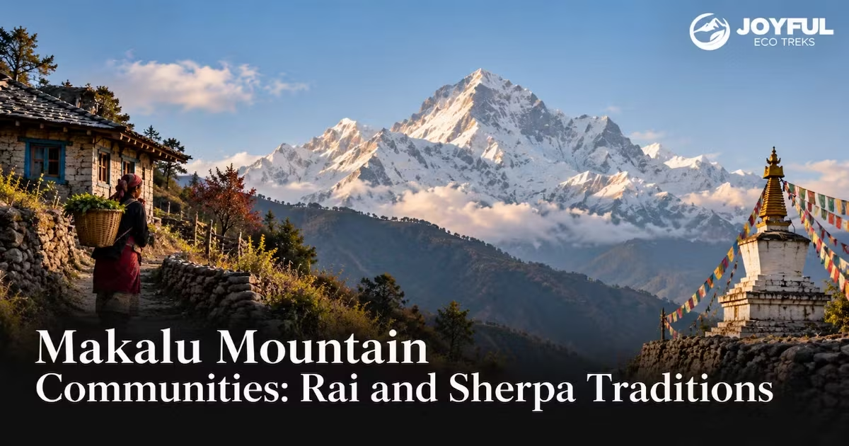
Makalu Mountain Communities: Rai and Sherpa Traditions
The Makalu mountain communities you meet on the walk to base camp are not one people, and their livelihoods shift sharply with altitude. In the lower corridor, Rai communities and other hill households work millet, maize, and rice terraces. Around Tashigaon, Sherpa settlement becomes more visible, while above the last permanent village seasonal pastures and high-altitude camps replace year-round farming. All look up at the same wall of rock, but language, ritual, livelihood, and land use do not change along one clean ethnic line. That vertical transition, not the summit alone, is what makes this corridor worth reading before you walk it.
Table of Contents
ToggleWhy Makalu’s Mountain Communities Stay a Cultural Blind Spot
Most route guides give the people of this valley a single paragraph: Rai low, Sherpa high, everyone Buddhist or Kirat, on to the itinerary. The Makalu mountain communities inside the park are denser than that paragraph admits. A 2025 national review of buffer-zone community forestry reports 39,696 people in the Makalu-Barun buffer zone, while Department of National Parks and Wildlife Conservation documentation identifies Rai, Sherpa, and Singsawa (Bhote) among the major ethnic groups. The administrative boundary was drawn for conservation, not as a map of culture.
Three major communities inside one park boundary
The latest Makalu-Barun park brochure currently available from the Department of National Parks and Wildlife Conservation lists Rai, Sherpa, and Singsawa (Bhote) as the major ethnic groups in the park and buffer zone. That still does not make the trekking corridor a tidy three-part map. Settlement, language, intermarriage, farming, herding, and seasonal movement overlap from village to village. Treat any simple ‘Rai below, Sherpa above’ summary as a useful first sketch, not a hard cultural border.
What the trekking literature leaves out
Nearly every published overview, including this site’s own survey of Sherpa and Rai traditions, works at the level of “Rai” and “Sherpa” as whole categories. That is where the detail dies. Kulung are recorded separately in Nepal’s 2021 census, although travel writing often places them inside the wider Rai/Kirati cultural umbrella. Their language, ritual practice, burial tradition, and land history deserve that distinction. Skip it and you get culture as wallpaper: real enough to photograph, too vague to understand.
Kulung Communities: The Farmers Who Predate the Trekking Routes
Nepal’s 2021 census records 33,388 people identifying as Kulung by ethnicity, while 37,912 people reported Kulung as their mother tongue. Their historic core lies in Mahakulung and the Hongu valley of Solukhumbu, with Kulung settlements also extending into Sankhuwasabha and other parts of eastern Nepal. Along the lower Makalu approach, Rai and other hill communities have farmed these slopes long before trekking became a local industry.
The Arun watershed and the rice-millet farming calendar
Traditional Kulung livelihoods in their core areas revolve around upland agriculture, especially millet and maize, with other crops varying by elevation and locality. Historical ethnography from the Hongu valley also records livestock keeping, hunting, fishing, and seasonal use of pasture as parts of the wider household economy.
The farming year sets the ritual clock. Across Rai/Kirati communities, Ubhauli and Udhauli mark seasonal cycles, but the names and practices differ by language group. In Kulung usage, the Ubhauli observance is known as Tos. Ubhauli, around Baisakh Purnima in April or May, is associated with the start of the growing season, while Udhauli in November or December marks the seasonal turn after harvest. Millet does double duty: it feeds the household and, fermented into tongba, can accompany hospitality and social occasions. Raksi, the clear distilled spirit, also appears in domestic and ritual settings. Neither is simply a trekking-trail novelty; both sit inside wider social customs that vary by household and occasion.
Burial, sacred groves, and clan-held land
One documented distinction in Kulung ritual life is burial: Kulung communities traditionally bury their dead rather than following the cremation practices common in many neighbouring Hindu communities. Funeral practice still varies by family, place, and religious affiliation, so it should not be used as a simple way to label a village. That attachment to ground has a legal shadow.
Kulung land was historically held under Kipat, a clan-based tenure in which local clan groups exercised corporate rights over uncultivated land and resources while cultivated plots could be held by households. Descent shapes those clans in ways outsiders rarely notice. Kulung marriage rules documented in community and ethnographic sources prohibit close unions through several generations of maternal and paternal descent.
Charles McDougal’s 1973 field study of Kulung communities in the Hongu valley found that more than 90 percent of marriages occurred within the same locality and more than 80 percent within the same village. The study describes historical patterns from fieldwork conducted in 1964-65, so they should not be read as a current census of marriage practice. Kulung households today may identify with Kirat, Hindu, Buddhist, or other religious traditions, and those affiliations do not reduce to a single percentage or ritual system.
Tashigaon: Where Rai Territory Meets Sherpa Ground
Tashigaon sits at roughly 2,070-2,100 metres on most current trekking itineraries and is widely described as the last permanent settlement on the standard Makalu Base Camp route. Above it, the trail quickly leaves continuous village settlement for forest, high camps, lodges, and seasonal pasture sites. That makes Tashigaon a practical hinge in the journey, but not a precise ethnic border.
A village that works as a cultural hinge
Below Tashigaon, terrace farming dominates much of the settled landscape. Tashigaon itself is described in different sources as Sherpa, Rai, or mixed, which is a useful warning against drawing a hard ethnic line through one village. From there upward, Sherpa settlement and Tibetan Buddhist cultural markers become more visible, while the domestic economy shifts away from continuous terrace agriculture toward seasonal pasture, trekking lodges, and high-altitude movement.
What shifts in language, diet, and ritual above the village
Food, language, and ritual all change as the route climbs, but none of them works as a precise altitude marker. Lower settlements draw heavily on maize, millet, rice, and local alcohol traditions, while higher Sherpa households and lodges are more likely to reflect Tibetan-influenced foods, Buddhist symbols, and yak-based products. Kulung is a Kiranti language; Sherpa is Tibetic. The overlap between them is social and geographic rather than a line a trekker can measure by the menu.
Sherpa Pastoral Life Above the Tree Line
Above the tree line, the arithmetic of survival changes. Crops will not reliably ripen, so the household economy rests on the yak and on movement between elevations rather than on the soil underfoot.
Transhumance between valley farms and summer pastures
Sherpa and other pastoral households in the Makalu-Barun highlands have long practised transhumance, moving livestock seasonally between altitude bands. In winter, herds descend toward lower shelters and settlements; during the warmer and monsoon months, animals move into high pastures, or kharka, including alpine grazing areas in the Barun valley. Research in Makalu-Barun shows that this vertical movement continues, although livestock numbers and reliance on pastoralism have declined as labour, schooling, migration, tourism, and other livelihood options have changed. The rhythm is old, but it is neither static nor untouched by park and local management.
Gompa festivals in the high corridor
Collective ritual clusters in the cold months, when the herds are down and people are together. Losar, the Tibetan new year, and village gompa festivals gather scattered households into the monastery for a few days of shared observance. Set beside the seasonal agricultural festivals practiced in Kulung and other Rai/Kirati communities, the contrast is useful but not absolute: farming cycles shape one set of observances, while Buddhist and pastoral calendars shape others. Same mountain overhead, overlapping ritual clocks.
What Locals Call the Mountain, and Why the Names Get Confused
Here the popular travel-blog version and the documented record part ways, and it is worth getting right. Makalu is often linked to the Sanskrit Mahakala, an epithet of Shiva commonly translated as ‘Great Black One’ or ‘Great Darkness’, but the mountain’s etymology is not settled. Historical discussions also record Khamba Lung or Kama Lung as possible roots. What is much clearer is that Kumbhakarna belongs to a different mountain, not Makalu.
Why Kumbhakarna should not be used for Makalu
Kumbhakarna is associated with Jannu, the roughly 7,710-metre peak in the Kanchenjunga massif of Taplejung, which Limbu tradition also knows as Phoktanglungma. Copying that name onto Makalu conflates two separate mountains. Some secondary sources also record Makalungma as a Limbu form associated with Makalu, but the published evidence is not strong enough to assign it a precise ‘maternal protective deity’ meaning here. The careful position is simpler: Makalu’s name has competing etymological explanations, while Kumbhakarna/Phoktanglungma belongs to Jannu rather than Makalu.
Ritual restrictions and the mountain’s sacred boundary
Sacred peaks, passes, shrines, and landscape features carry ritual meaning across many Himalayan traditions, but the exact restrictions vary by community and site. For a trekker, the practical rule is straightforward: treat mani walls, chortens, prayer flags, cairns, monasteries, burial places, and other marked sacred sites as living religious spaces rather than photo props, and follow local guidance where a place has specific rules.
How Park Governance Reshapes Ancestral Livelihoods
Makalu-Barun became Nepal’s eighth national park in 1992, while the 830-square-kilometre buffer zone around it was declared in 1999. That means the area’s conservation framework developed in stages: first the national park, then a buffer-zone system intended to combine conservation with community resource use and local development.
Buffer zone rules that redirect herding and firewood
According to Government of Nepal documentation, Makalu-Barun National Park covers 1,500 square kilometres and its buffer zone covers another 830 square kilometres. Grazing, firewood collection, fodder cutting, and other resource uses are therefore shaped by protected-area zoning, buffer-zone rules, and community-forest management rather than by customary practice alone. Research from the park’s planning period captured how difficult that translation could be: villagers described older tenure as overlapping and flexible rather than as neat blocks on a map. That historical concern matters, but it should be read as evidence from the park’s planning and early implementation period rather than as a description of every household’s experience today.
Community forestry and which households it protects
Community forestry is one of the main mechanisms for managing everyday forest use in the buffer zone. A 2025 national review reports 95 buffer-zone community forests in Makalu-Barun, covering about 25,716.5 hectares and involving 7,957 households. These groups manage forest use through recognised user institutions and operational plans. That formal system gives communities a role in resource management, but it also translates older, overlapping customary claims into mapped management units. The result is not an end to traditional livelihoods; it is a more formal framework through which many of those uses are now negotiated.
Who Lives Where: An Altitude-by-Livelihood Map of the Corridor
Pulling census figures, park documentation, and trek-itinerary altitudes together, the Makalu mountain communities are easier to understand as overlapping livelihood zones than as ethnic bands sorted cleanly by elevation. The lower approach through Num and Seduwa sits in a settled farming landscape where Rai and other hill communities cultivate terraces; Seduwa is also the main park headquarters and entry point on the standard route.
Tashigaon, at roughly 2,070-2,100 metres, is widely treated as the last permanent village before the long high section. Above it, the route passes forest, kharka, lodges, and seasonal pasture sites rather than a chain of year-round villages. Sherpa households and Tibetan Buddhist cultural markers become more visible in the higher corridor, while Singsawa/Bhote communities form part of the wider Makalu-Barun population, particularly in northern Sankhuwasabha. None of those groups fits a single altitude band perfectly. The underlying pattern is economic as much as ethnic.
Terrace agriculture depends on soil, warmth, and a growing season; pastoral use depends on access to seasonal grazing; tourism now adds lodges, guiding, portering, and supply work to both. Park and buffer-zone rules sit on top of that older altitude logic and shape how land and forest resources are used today.
Moving Through These Villages Without Breaking Trust
Most friction on this trail is accidental and easily avoided. The Makalu mountain communities extend real hospitality, and most of it survives a few clumsy moments, but a handful of habits keep the trust intact.
Etiquette in Num, Seduwa, and Tashigaon
In the Kulung villages, a home is not a teahouse chain. Hospitality is personal, and tongba offered to you carries weight, so decline gently if you must and never wave it off. Ask before photographing people, mourning, or sacred groves; burial ground in particular is not scenery. Higher up, in Sherpa settlements, walk clockwise around mani walls and chortens, keeping them on your right, and treat prayer flags and shrines as the live religious objects they are. This site’s guide to religious-site etiquette in Nepal covers the specifics.
What trekkers most often misread
Two mistakes are easy to make on this corridor. First, visitors flatten everyone into a single “mountain people” idea and expect Kulung, Rai, Sherpa, and other communities to share the same customs. They do not, and practices can also vary within the same community from village to village. Second, trekkers treat sacred landscape features as a backdrop. A cairn, mani wall, chorten, burial place, or shrine may carry real ritual weight, so climbing on it, moving objects, or photographing people without asking can break trust quickly. Move as a guest, not as if the trail is culturally empty between camps.
FAQs
Do Kulung communities near Makalu share the same oral traditions as Rai groups elsewhere in eastern Nepal?
They share a wider Kirati cultural field, but the details are not interchangeable. Rai/Kirati communities speak different languages and use different names, narratives, ritual specialists, and festival forms. In Kulung usage, Ubhauli is known as Tos; Kulung burial traditions and the clan-land history documented under Kipat also have their own local forms. Treat the wider Kirati connection as a relationship, not as proof that every Rai or Kulung community follows the same Mundhum stories or ceremonies.
What is Kumbhakarna, and is it another name for Makalu?
No. Kumbhakarna is associated with Jannu, the roughly 7,710-metre mountain in the Kanchenjunga massif of Taplejung, where the Limbu name Phoktanglungma is also used. Makalu is a different peak. Its own name is often linked to Mahakala, although the etymology remains debated, and some secondary sources record Makalungma as a Limbu form. The safest conclusion is that using Kumbhakarna for Makalu conflates two separate mountains.
Can trekkers visit buffer zone villages in Makalu-Barun National Park without a restricted area permit?
On the standard Makalu Base Camp route, Nepal Tourism Board currently requires a licensed trekking guide and an agency-issued TIMS card, along with the Makalu-Barun National Park entry permit. As of 2026, the park entry fee is NPR 100 for Nepali visitors, NPR 1,500 for SAARC nationals, and NPR 3,000 for other foreign visitors. A Restricted Area Permit applies if an itinerary enters Nepal’s officially restricted parts of Sankhuwasabha, which currently include Bhotkhola Rural Municipality wards 1-5 and Makalu Rural Municipality ward 4. Confirm the exact route with a registered trekking agency before departure because permit boundaries and fees can change.
How does the national park boundary affect herding routes and firewood collection for Sherpa households in the corridor?
Protected-area and buffer-zone rules directly affect how grazing, firewood, fodder, and forest products are managed, but the effect is not a simple blanket ban on traditional use. Access is shaped by park zoning, buffer-zone institutions, and community-forest operational plans. Historical research shows that these formal boundaries sometimes sat awkwardly beside older overlapping tenure systems. The result is continued herding and forest use inside a more regulated framework rather than an automatic end to those livelihoods.
Are there permanent settlements above 4,000 metres in the Makalu region, or only seasonal herding camps?
On the standard Makalu Base Camp route, Tashigaon at roughly 2,070-2,100 metres is widely described as the last permanent village. Above it, trekkers encounter high camps, lodges, kharka, and seasonal pasture sites rather than another chain of year-round settlements. That statement applies to the standard trekking corridor; it should not be read as a claim that no permanent settlement above 4,000 metres exists anywhere in the wider Makalu region. To place these communities in the wider journey, see the Makalu Region overview for what surrounds the cultural villages before and after, and the Makalu Base Camp Trek route for how the corridor unfolds day by day.

All Categories