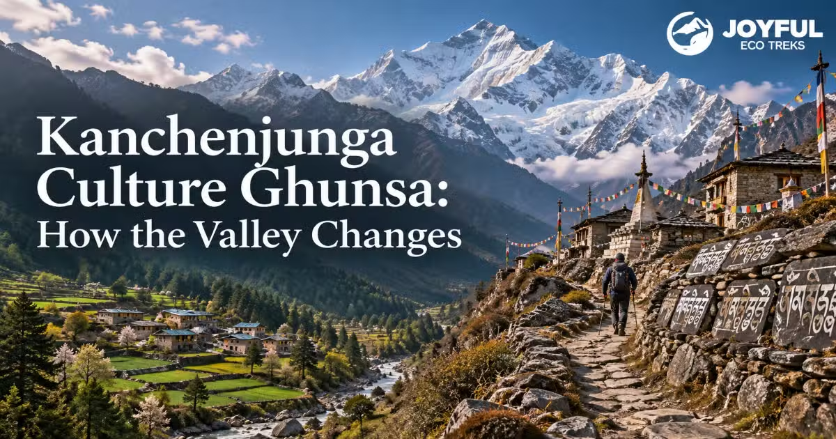
Kanchenjunga Culture Ghunsa: How the Valley Changes
Walk north from Taplejung, and the culture changes under your boots before the scenery does. Many introductions to Kanchenjunga culture give you a flat list: Limbu and Rai down low, Tibetan Buddhist communities higher up, one monastery at the top. The broad pattern is real, but it is more useful on the trail when read as a gradual change. The corridor from the lower Tamur valley up to Ghunsa, commonly listed at roughly 3,475 to 3,595 meters depending on the source, is a gradient you can read altitude band by altitude band: in the drink your host may pour, the religious markers beside the trail, and the languages spoken in homes and lodges.
This piece maps that gradient the way a walker actually meets it. If you want the sacred-mountain stories or the Mundhum oral scripture behind these communities, those live in their own articles. Here the subject is narrower and, for a trekker, more practical: who lives at each elevation, what they believe, and how to recognize the cultural changes along the route.
One Trek, Two Cultural Worlds
Two poles help define the route. At the bottom sit the Limbu and Rai, Kirati peoples with distinct ritual traditions. Among Limbu communities, Mundhum-based practices and ritual specialists such as the Phedangma remain important, alongside Hindu and other influences. At the top sits Ghunsa, an upper-valley settlement where Tibetan Buddhist traditions, stone houses, prayer flags, and a village gompa are prominent.
Between those poles, especially through the roughly 2,500 to 3,200 meter middle corridor, cultural markers overlap across villages. The boundary is gradual rather than fixed to one elevation. That middle band is some of the most interesting cultural ground on the trek and the real subject here.
Table of Contents
ToggleLimbu and Rai heartland: lower valleys from Taplejung to Yamphudin
Taplejung district is a major Limbu homeland. It is the administrative gateway to the trek and the heartland of a people whose presence here long predates the trekking industry. From the roadhead, the trail threads Limbu and Rai settlements: Chirwa low in the Tamur gorge, Sekathum near the confluence of the Ghunsa Khola and Tamur system, and on the southern approach, Yamphudin, a Limbu-dominant village that many circuit itineraries use as a cultural anchor before the climb. Rai communities share parts of the lower country too, with their own languages and ritual traditions.
Where Bhote settlements begin and why altitude drew them there
Bhote is a broad label sometimes applied to Tibetan-origin Himalayan communities. Along the upper Tamur, the Walung are a distinct indigenous people with Tibetan roots; official descriptions also note that some Walung people may be recorded under labels such as Bhote, Lama, or Sherpa. Their traditional livelihoods included animal husbandry and cross-border trade, and the upper Tamur placed communities close to high pastures and historic routes into Tibet. That background explains much of what a trekker sees around Ghunsa.
Limbu and Rai Communities in the Lower Kanchenjunga Valleys
Spend an evening in a lower-valley home, and local ritual traditions can become visible in quiet ways: in household observances, ancestral practices, and the ritual specialists consulted during important life events. Among the Limbu, one of those specialists is the Phedangma.
The Phedangma and the lower-valley worldview
The Phedangma is an important Limbu ritual specialist: involved in Mundhum recitation and rites connected with life-cycle events, healing, ancestors, and the spiritual world. Limbu tradition also recognizes other ritual specialists, including Samba, Yeba, and Yema, whose roles can differ by ritual and community.
Ritual knowledge is carried through oral transmission, practice, apprenticeship, and community recognition, while some traditions also describe spiritual calling or inherited qualities. That combination of performed knowledge and ritual authority helps explain why these specialists remain important in a tradition where sacred knowledge is lived and recited rather than confined to a single written text.
Tongba, harvest, and the lower-valley social calendar
Tongba, warm fermented millet drink sipped through a straw from a wooden or metal vessel, is something trekkers may encounter in Limbu and other eastern Himalayan communities. It is worth reading as more than a menu item. Millet belongs to the agricultural life of the middle hills, and sharing a drink can be a social act of hospitality. Higher in the valley, butter tea becomes a more visible Tibetan-Himalayan marker. The contrast is useful, but neither drink should be treated as a fixed test of a household’s identity.
The Transition Zone Between 2,500 and 3,200 Meters
Above Amjilosa, the cultural signals become less tidy. Nepali remains widely used, while Buddhist markers such as prayer flags, mani walls, and chortens become increasingly visible as the trail rises. This is not a line you cross. It is a practical trekking band in which the visible cultural landscape changes gradually.
Salt and trade routes that helped shape the overlap
Trade helped shape that overlap. Walung traders historically moved through the Tamur corridor, carrying salt and other goods from Tibet into lower Taplejung and returning with goods from the south. Repeated movement through the valley connected highland and lower-valley communities economically and culturally. That history helps explain why the transition is spread across several settlements rather than fixed at one altitude.
Reading the transition at village scale
The safest way to read the transition is at village scale rather than by assigning a religion or ethnicity to individual households. Through Amjilosa and Gyabla toward Phale and Ghunsa, Buddhist markers become more frequent and Tibetan-Himalayan architectural features more visible, while lower-valley Limbu and Rai influences remain part of the wider region. For a trekker, the practical takeaway is simple: the middle corridor is culturally mixed, and its boundaries are gradual.
Ghunsa at Roughly 3,475-3,595 Meters: Tibetan Buddhist Life in the Upper Valley
Ghunsa is where the upper-valley pattern becomes much more visible. The settlement is associated with the Walung community, a Tibetan-origin indigenous people of Taplejung. Local and official identity labels can vary, and some Walung people may also be recorded as Bhote, Lama, or Sherpa. Tibetan Buddhism is prominent, while official ethnographic descriptions of Walung tradition also document older Bon, nature-based, and shamanic elements in lifecycle practices.
Elevation figures vary between maps and trekking sources, with Ghunsa commonly placed in the roughly 3,475 to 3,595 meter range. Language is another important marker of the upper valley. Walung communities speak a Tibeto-Burman language commonly referred to as Walung or Walungge, with local speech associated with Ghunsa often described as Ghunsake. Nepali is also widely used for communication beyond the community.
How the Ghunsa gompa anchors the community calendar
Ghunsa’s Buddhism is best understood as a lived community practice rather than as a monastery-centered experience for visitors. Tashi Chhyoling, the village gompa, is locally and in travel accounts described as very old, with some reports placing its history at more than a thousand years. That age should be treated as a traditional or reported claim rather than a securely established archaeological date. Its walls, prayer flags, mani stones, and ritual role remain important parts of the settlement.
Recent academic research describes the monastery as only occasionally used today. Current staffing, opening, and ritual activity can change, so trekkers should verify access locally rather than expecting a resident-monk experience.
Yaks, the salt-trade memory, and high-pasture rhythms
The economy here has long been shaped by altitude. Animal husbandry, high pasture, agriculture, and cross-border trade all feature in descriptions of Walung livelihoods. The historic salt trade helps explain the north-facing orientation of upper-valley settlements and their long connection with Tibet, even though the trade is far less central than it once was.
Ghunsa also has a history of seasonal winter movement, with many families traditionally leaving for lower elevations during the coldest months. That pattern has been changing, and recent reporting shows more year-round winter residence than older descriptions suggest. The community you meet, and how active village life feels, can still depend heavily on the season.
The Altitude-Band Map from Taplejung to Ghunsa
Putting the settlements into altitude bands makes the cultural change easier for trekkers to recognize on the trail. Read the table top to bottom as a walk uphill. Elevations are approximate, and the figures for several villages, especially Ghunsa, vary between sources. The bands are a practical trekking framework, not hard ethnic or religious boundaries.
|
Altitude band |
Villages (approx.) |
Community presence |
Languages commonly heard |
Visible religious traditions |
Hospitality example |
Built landscape marker |
|
~1,200-1,600 m |
Chirwa (~1,270 m), Sekathum (~1,570 m) |
Limbu, Rai, and other lower-valley communities |
Limbu, Nepali, and local languages |
Kirati/Mundhum traditions alongside Hindu and other influences |
Tongba may be served |
Timber and bamboo more common; local household and ritual spaces |
|
~2,000-2,500 m |
Yamphudin (~2,080 m, south route), Amjilosa (~2,510 m) |
Limbu communities with increasing upper-valley Himalayan influence |
Nepali, Limbu, and some Tibetan varieties depending on settlement and household |
Overlapping practices; Buddhist markers become more visible |
Tongba and tea |
Mixed materials; prayer flags and Buddhist trail markers may appear |
|
~2,700-3,200 m |
Gyabla (~2,730 m) |
Transition toward upper-valley Walung/Tibetan Buddhist settlements |
Nepali and Tibetan varieties |
Tibetan Buddhist practice increasingly prominent |
Butter tea may appear |
Stone walls, prayer flags, mani features |
|
~3,475-3,595 m |
Ghunsa |
Walung community; local and official labels may vary |
Walung/Ghunsake and Nepali |
Tibetan Buddhism, with older Bon and local/shamanic elements documented in Walung tradition |
Butter tea (po cha) |
Stone houses, chortens, mani walls, gompa |
The value of the table is the middle two rows. The lower and upper ends are easy to simplify; the gradient is what happens in between.
What Changes Between Chirwa and Ghunsa: Reading the Gradient
You do not need to reduce the route to a strict cultural boundary to notice change. Two useful things to watch are how the built landscape changes and which forms of hospitality and religious markers become more common as you climb.
Stone and chortens become more prominent higher in the valley
Around the lower valleys, timber and bamboo are more common building materials. Climb higher and the palette hardens: stone becomes more prominent, and Buddhist markers such as chortens, mani walls, and prayer flags appear more frequently. By Ghunsa, stone houses and Tibetan Buddhist features are a defining part of the village landscape. Architecture can therefore help a trekker read the gradual cultural shift, but it should not be treated as a precise ethnic boundary.
From tongba to butter tea in your host’s kitchen
Hospitality offers another clue, though not a rule. Tongba is associated with lower and middle-hill communities of eastern Nepal, while butter tea, or po cha, is a familiar Tibetan-Himalayan drink higher in the valley. A trekker may notice that change in what lodges and households offer, but individual preferences and menus vary. The drinks are cultural markers, not a diagnostic test of identity.
Etiquette at Animist Shrines and Buddhist Gompas on One Route
Because different traditions share the broader trekking corridor, the same trekker needs to pay attention to local practice rather than assuming the route is culturally uniform.
At a Buddhist gompa or a mani wall, walk clockwise around chortens and mani walls, keeping them on your right; remove shoes where local rules require it; keep voices low; and ask before photographing an altar or a person at prayer. Donations or offerings are generally optional unless a local arrangement says otherwise. At a lower-valley ritual site, the etiquette is less about a formal circuit and more about deference. A Phedangma’s ritual space or a household shrine is a working religious setting, not a monument to tour. Do not touch offerings, do not photograph a rite in progress without clear permission, and follow your host’s lead on where you may and may not stand. The through-line in both cases is respect for a living practice, even when the specific gestures differ.
Questions About Kanchenjunga Culture and Ghunsa
Where does culture shift from Limbu-Rai to upper-valley Walung communities?
The shift is gradual, not fixed to a single altitude. As a practical trekking framework, the middle corridor around Amjilosa and Gyabla is where Buddhist cultural markers become increasingly prominent while lower-valley Limbu and Rai influences remain part of the broader region. By Ghunsa, Walung and Tibetan Buddhist cultural features are much more visible. The roughly 2,500 to 3,200 meter band is best treated as an approximate transition, not an ethnic boundary.
Do people in Ghunsa speak Nepali or a Tibetan language?
Both. Walung communities use a Tibeto-Burman language commonly referred to as Walung or Walungge, with speech associated with Ghunsa often described as Ghunsake. Nepali serves as a wider language of communication, especially with visitors and people from outside the community.
What do trekkers first notice entering the upper-valley Buddhist zone?
Usually the built and religious landscape: prayer flags, mani walls, chortens, and more stone construction become increasingly visible as the route climbs. Butter tea may also appear more often in upper-valley hospitality. These are useful signs of a gradual cultural transition, not fixed rules for identifying a household or community.
How did Walung communities become established in the upper Tamur region?
Official ethnographic descriptions identify the Walung as a Tibetan-origin indigenous people of Taplejung, with historic settlement in places including Olangchungola, Yangma, Ghunsa, Lungthung, and Lelep. Their traditional livelihoods included animal husbandry and cross-border trade, which connected the upper Tamur region closely with Tibet for generations.
Is the Ghunsa monastery open to trekkers, and what rules apply?
Access to Tashi Chhyoling can vary, and recent research describes the monastery as only occasionally used, so confirm current access locally or with your guide. Follow any posted or local instructions, remove shoes where required, move clockwise around chortens and mani walls, keep voices low, and ask before photographing altars or people at prayer. Donations are optional unless a local arrangement specifies otherwise. Treat the gompa as an active religious place rather than a sightseeing stop.
Ready to see where each of these bands falls on your own itinerary? The Kanchenjunga region guide maps the cultural gradient onto the trek day by day, including which villages you overnight in at each altitude, whether you walk the full circuit or the north base camp route.

All Categories