Makalu Buddhist Traditions and the Khembalung Beyul
Most trekking guides to the Makalu region mention visible Buddhist markers but provide little detail about the sacred geography associated with Khembalung. The mountain’s climbing record is exhaustively documented: the elevation, the 1955 French first ascent, the standard rotation of camps. Its sacred geography is not. The wider Makalu–Arun region contains sites associated with Khembalung, a hidden valley in Tibetan Buddhist tradition, although historical accounts do not agree on its exact physical location or extent. Know what a beyul is, and you stop seeing a scattering of decorative stones. You start recognising how Buddhist sacred geography forms one layer of a culturally varied landscape extending from the lower settlements towards the high valleys.
Table of Contents
ToggleWhy Khembalung Holds a Different Sacred Status
A beyul is not a metaphor for a beautiful place. In the Nyingma school of Tibetan Buddhism, it is a refuge valley described through religious texts, oral interpretation, and local sacred geography. Within the tradition, a beyul’s sacred status is connected to this cycle of concealment and revelation, while local communities also interpret the landscape through oral accounts and pilgrimage practice.
Khembalung, also rendered locally as Khambalung or Khempalung, is a documented name in the region’s sacred geography. Johan Reinhard recorded the Tibetan form as Khenpa lung, with lung meaning “valley,” but the available academic source does not establish “Nghe-Beyul Khimpalung” as its formal scriptural name. The Barun caves are among several sites associated with Khembalung rather than proof that the whole Barun Valley has one uncontested scriptural identity.
Different Tibetan Buddhist traditions give different numbers and lists of hidden valleys Khembalung is an important documented beyul, but the available evidence does not support a universal total of 108, a single authoritative list of seven, or a fixed rank for Khembalung. Sacred geography influenced how some communities understood the region, while settlement patterns were also shaped by migration, agriculture, grazing, trade, and terrain.
Makalu in Tibetan Buddhist Cosmology
In Nyingma religious tradition, beyuls are associated with protective deities and Guru Rinpoche. This sacred framework shapes how mountains, caves, rivers, and other landscape features may be understood, but the available Khembalung source does not identify Makalu itself as the guardian of the hidden valley.
The contrast between expedition history and sacred geography is still useful, but descriptions of how local Sherpa communities speak or behave around Makalu require direct interviews. What can be said safely is that Buddhist sacred geography gives religious meaning to particular mountains, caves, water sources, chortens, and pilgrimage routes beyond their physical features.
Khembalung: Sacred Caves Associated with the Barun Valley
Khembalung is associated with several sacred caves rather than one undisputed pilgrimage core. Johan Reinhard documented a principal pilgrimage cave near Dobatak and reported, through a lama from Seduwa, twin caves named Shengi Duka and Shechi Duka along the Barun River, approximately one day’s walk below Makalu Base Camp. The same account records disagreement over whether the Chhoyang, Iswa, and Barun sites form three parts of Khembalung or whether Khembalung is located only in the Chhoyang Valley.
Knowing these names changes how the upper Barun can be read. The high approach includes sacred places associated with a much older pilgrimage tradition, although the twin caves should not be presented as the sole reason the valley functions as a pilgrimage destination.
Their remote location fits the wider beyul tradition in which a hidden valley is fully revealed only at the appropriate time and to properly prepared practitioners. That religious idea should not be treated as evidence of a formal modern access restriction. Trekkers should confirm present conditions and local customs with residents, guides, or religious custodians before approaching a sacred cave.
Monasteries and Gompas Between Num and the Upper Barun
Do not expect a Tengboche here. The Khumbu has a large, famous central monastery anchoring a whole network of affiliated gompas and drawing pilgrims and trekkers by the thousand. Along the Makalu route, there is nothing on that scale, and that absence is informative.
Tashigaon, commonly described as the last permanent Sherpa village on the standard route before the high alpine section, sits at about 2,100 metres and is widely reported to have a small community gompa. Its current operating status, religious affiliation, and visitor access should be confirmed locally rather than described as reliably active without recent documentation.
Publicly available sources do not establish the Nyingma sub-lineage of the Tashigaon gompa or identify its founding lama. Thupten Choling near Junbesi and the Dudh Kunda route belong to Solukhumbu and should not be presented as a Makalu Base Camp-route monastery. The monastic history of Tashigaon requires local verification rather than an assumed affiliation.
For a trekker, a short gompa visit is unhurried and low-ceremony. Remove your shoes, keep quiet, move clockwise, and ask before photographing anything if a resident lama is present. The purpose of a visit is respectful observation of a community religious space, without assuming that local practice exists for visitors.
Makalu Buddhist Traditions Along the Route: Reading the Trek as Religious Space
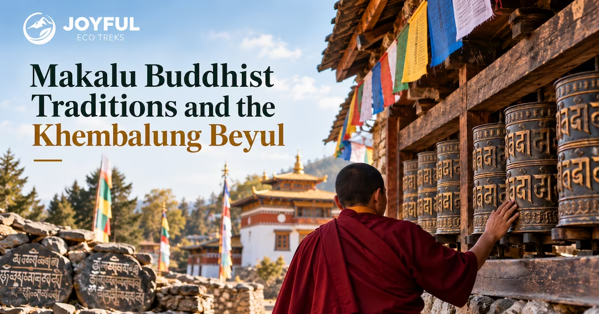
Once you can read them, the markers along the trail tell a continuous story. Mani walls, the long low walls of carved stone tablets, cluster at village entrances, where they function as thresholds, and accrete along well-travelled stretches of trail as an act of ongoing merit, each added stone a small devotion. A wall at a village edge carries a different meaning from a cairn at a lonely bend, and the placement is the meaning.
The high passes carry visible cairns and prayer flags, but not every trail cairn is necessarily a Buddhist monument. At Shipton La and Keke La, follow local guidance before adding stones or flags, and keep identifiable Buddhist monuments on your right when passing them clockwise. The specific liturgy and meaning of these two passes are not documented in the available record, so they should not be described as fixed boundaries between worlds without a local source.
The clearest pattern is spatial, and worth mapping deliberately. Reading publicly available route and cultural-geography information against the day-stops of the standard trek, JoyfulEcoTreks traces the density of Buddhist markers as a gradient rather than a constant:
-
Num and Seduwa (around 1,540 metres), lower approach: Ethnically and religiously mixed settlements that include Rai and other communities.
-
Tashigaon (about 2,100 metres): A predominantly Sherpa village reported to have a small community gompa, whose current status should be confirmed locally.
-
Shipton La and Keke La, the high crossings: active cairn-and-flag sites at each pass.
-
Upper Barun toward Base Camp: A high valley containing the Shengi Duka and Shechi Duka caves, which are among several sites associated with Khembalung.
The distribution of religious markers may change along the route, but the cultural transition is gradual rather than a precise boundary. Trekkers should pay attention to both Buddhist and Kirat sacred practices throughout the inhabited sections of the journey.
Sherpa Buddhist Traditions Specific to the Makalu Region
Sherpa Buddhist practice in the wider Makalu region may share features with traditions documented in Khumbu, but the scale and local observance require village-level confirmation. Dumje, or Dumji, is well documented in Khumbu as a Sherpa festival connected with Guru Rinpoche and community protection. Its timing and duration vary by locality, commonly falling in June or July during the fourth or fifth Tibetan lunar month.
Dumje is best documented in Solu-Khumbu, including villages such as Namche and Pangboche, while the available public record does not confirm its precise calendar or ritual programme in smaller Makalu settlements. Claims about masked dances, Logpar, audience size, or the absence of cameras in a particular Barun village require direct local evidence. For the calendar and form of any local observance, ask the village community, gompa representative, or an experienced local guide.
That intimacy carries into ordinary practice. Most of what a passing trekker witnesses is lay religion rather than monastic ritual: flags strung at a house, a mani wall lengthened by one stone, a butter lamp lit at dusk. These practices belong to community religious life and should not be interpreted as either performed or unperformed without speaking to the people involved.
Three Mistakes Visitors Make Around Sacred Sites
The first is treating mani walls and pass cairns as photogenic backdrops. These are active religious objects. Three conduct rules carry most of the weight and are worth memorising before you go: keep identifiable Buddhist structures such as mani walls and chortens on your right as you pass, moving clockwise; never remove or rearrange a carved stone; follow local guidance before adding anything to a cairn or tying prayer flags; and ask before photographing a shrine’s interior or anyone at prayer. JoyfulEcoTreks’ guide to religious-site etiquette in Nepal covers the wider set, but those three rules are the ones this route demands.
The second mistake is the important one, and it sits at the core of any honest account of Makalu Buddhist traditions. Visitors routinely fold the whole valley into a single “Buddhist culture,” which erases the people in the lower gorge. Many Rai communities maintain Kirat and Mundhum traditions with household ritual specialists, while many Sherpa communities practise forms of Tibetan Buddhism centred on lamas, gompas, and festivals. These traditions do not occupy two rigid elevation bands; communities and religious practices can be mixed, and Khembalung itself has Buddhist, Rai, and Hindu pilgrimage associations. The fuller account of Rai and Sherpa traditions sits alongside this piece for exactly that reason. Apply the beyul framework to the Rai villages and you have not honoured a tradition, you have overwritten one.
The third mistake is assuming every sacred site has the same access conditions. Shengi Duka and Shechi Duka are sacred places associated with pilgrimage, but the available historical source does not establish a formal restriction system. Confirm current conditions and local customs before approaching a cave, shrine, or gompa, and follow the guidance of residents or religious custodians.
The Beyul as a Trekking Lens
Walk the Barun without understanding Khembalung and its associated sacred sites, and important parts of the region’s religious history remain easy to miss. Read it carefully, and the route reveals overlapping Buddhist, Kirat, and Hindu relationships with caves, settlements, mountains, water sources, and pilgrimage places.
Makalu Buddhist traditions are an important part of the trekking landscape, but the evidence does not show that they alone determined the modern route or the location of every settlement. The traveller who understands Khembalung can recognise Buddhist sacred sites without treating the entire journey, from Rai settlements to the glacier, as one uniform Buddhist landscape.
Questions Trekkers Ask About the Barun Valley’s Sacred Geography
What is a beyul, and why is the Barun Valley counted among the hidden valleys?
A beyul is a sacred refuge valley in Tibetan Buddhist tradition, often associated with guide texts and treasure teachings attributed to Padmasambhava. Khembalung is a documented beyul, but historical accounts disagree about its exact location and extent. Sites near Dobatak, along the Iswa River, and in the Barun Valley have all been associated with it, so the whole Barun should not be presented as an uncontested named beyul or as part of a universally ranked list.
Are the Khembalung caves accessible to trekkers, or are they restricted pilgrimage sites?
Treat them as sacred sites whose current access conditions require local confirmation. Reinhard reported Shengi Duka and Shechi Duka approximately one day’s walk below Makalu Base Camp and described them as important Barun sites associated with Khembalung. His account does not establish a formal permission system or identify them as the beyul’s sole pilgrimage core.
How do Sherpa Buddhist traditions here differ from those in the Everest-Khumbu corridor?
Both regions have strong Nyingma influences, although local institutions and practices vary. Khumbu has major monasteries such as Tengboche and well-documented festivals. The Makalu route includes smaller community religious sites, but the current status of Tashigaon’s gompa and the precise observance of Dumje in Makalu settlements require local confirmation.
Which monasteries on the Makalu route are active, and what can trekkers expect?
Tashigaon, at about 2,100 metres, is commonly described as the last permanent Sherpa village before the high section and is reported to have a small community gompa. Its current activity and visitor access should be confirmed locally. Thupten Choling near Junbesi and the Dudh Kunda route are in Solukhumbu, not on the Makalu Base Camp route. At any gompa, remove your shoes where required, keep quiet, follow local directions, and ask before photographing people or interiors.
What conduct rules apply at sacred passes and mani walls in the Barun Valley?
Three rules carry most of the weight. Keep identifiable Buddhist structures such as mani walls and chortens on your right as you pass, moving clockwise around them. Never remove or rearrange a carved stone. At high crossings like Shipton La and Keke La, do not assume every cairn has the same religious status; follow local guidance before adding stones or prayer flags, and ask before photographing anyone at prayer.
Read the full Makalu Base Camp Trek itinerary to see which sacred valleys, passes, and monastery stops fall on each day of the route.

All Categories